Endymion and MOT (Saturday) Forecast

Very uncertain on just how warm it will get on Saturday, as questions persist on how much cold air actually gets driven into the area. It will not be humid though, and temperatures should be very comfortable. Temperatures will drop into the 50s overnight, but it does not look to be colder than that at this time.
The difficult part of this is the details of exactly how warm.
Looks like a party cloudy day for the area, and the airmass will certainly be dry. The NWS Model Blend from 18z this afternoon (2/24) puts New Orleans with a high of 66. I think we end up cooler than that, maybe 62-64 in New Orleans due to the cloud cover. There’s a big caveat though, and that is most of the models are showing a break in the clouds around midday south of the lake, which could lead to temperatures getting into the upper 60s. Mobile, further east, will be warmer during the day as cloud cover will be less prevalent. The same general logic is going to hold though, with temps also falling into the upper 50s at night.
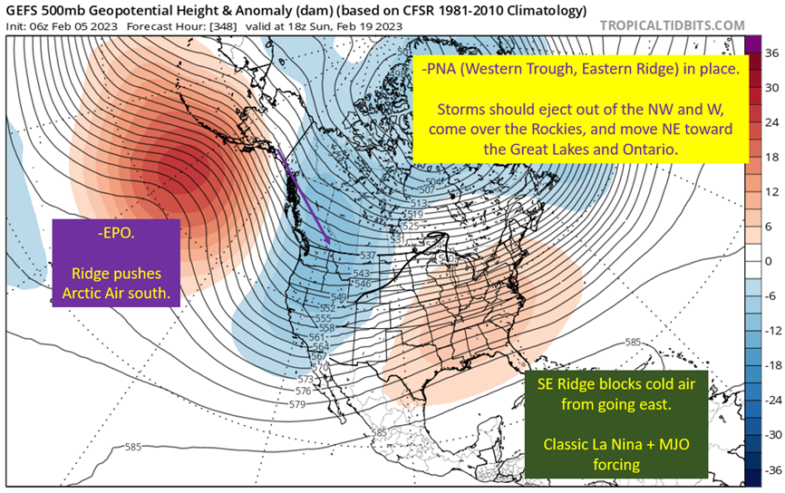
Image from Tropical Tidbits. Annotations by Jacob Caddell.
In short, there needs to be upper level help to push the cold air further SE and with flow being roughly parallel to the front it’s not going to move much. So the front is going to be stalled (again), this time hugging the coast of SE Louisiana. So how far does the front get Friday ends up being the question. Colder start won’t warm as much if the sun does peak out some middle of the day.
Going to be really easy to miss on the temperature forecast during the day. At least the night is a lot simpler, as clouds will certainly return by then and limit radiational cooling. So lows should end up in the mid 50s, with a weak disturbance approaching from the SW. Also, for those going to the Extravaganza, there is some potential for light showers early Sunday morning. Don’t be surprised if you get a little wet coming home.
Summary: It should be a very comfortable day, no matter if the warm or colder solutions hit, as our range is the 60s. Mid to upper 50s at night, with light rain potential very early Sunday morning. Still considerable uncertainty in the temperature forecast, but the range is basically across the 60s…so at least if my lower 60s forecast busts it will still be comfortable out.
Will be back tomorrow with the Bacchus/Joe Cain Day forecast and after Mardi Gras I’ll be releasing a series on severe weather basics to get you ready for Severe Season to come.
If you would like to support Gumbo Weather, go to my Patreon.


