
Tuesday Storms Yield To A Pleasant End Of The Week
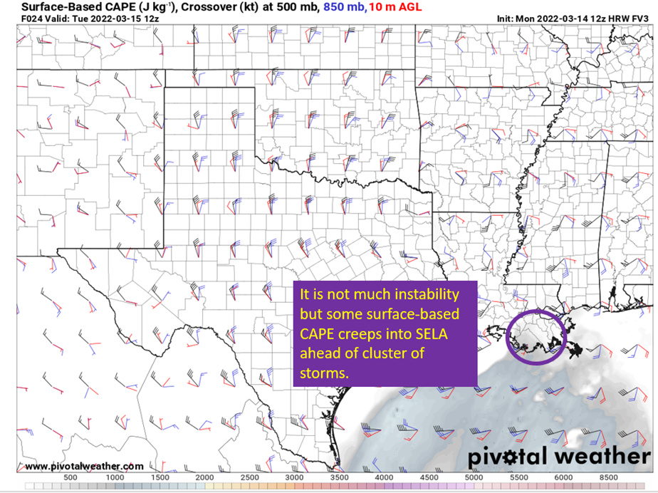
Upper low will slowly translate east across the northern Gulf Coast on Tuesday, presenting the potential for severe weather through the day on Tuesday. The main threat appears to be hail, with very cold mid-level temperatures moving into the area with the upper low. There is not much instability available, but the far southeaster parishes of Louisiana and coastal Mississippi have a window early in the morning (5-7 am roughly) to have some surface based convection fire as moisture off the gulf creeps northward in response to the surface low pressure.
Storms that do get surface based have the most energy to work with; therefore, will present the greatest threat to produce large (1” or greater) hail as a cluster of storms roll through the area.

Image from PivotalWeather. Annotations by Jacob Caddell.
This is just one model output concerning instability, with others showing some differences in just how far north it gets. The general idea should hold though, with some modest surface based instability getting into the near costal regions by tomorrow morning. With the cold and saturated 700-500 mb region, there’s some potential for 1”+ hail across the region in the morning round of storms. Most hail that forms will likely be small, but there’s enough potential for larger hail that makes it worth mentioning. Maybe park the car under the carport tonight.

Image from PivotalWeather with annotations by Jacob Caddell.
So the model derived soundings do show the hail potential as well, but the good news is the tornado and high wind threats look minimal. Though one or two quick tornadic spin ups isn’t impossible with any surface based storms.
The hail threat won’t be over after the morning round of storms, as cold air aloft continues to move into the area throughout the day. The end results are unusually steep lapse rates (the rate temperature drops with height) for southern Louisiana and with daytime heating there is potential for isolated storms to pop up through the afternoon. With the lapse rates being high, and an unusually cold airmass at 500 mb (around -20 C) any storms that do form will have potential to drop hail.

Image from PivotalWeather, showing 700 mb – 500 mb lapse rates over Louisiana tomorrow afternoon. Those areas with the yellow colors are above 7 C/km of temperature drop as you go upward. This is the main reason the hail threat will remain through the day and any storms that form should produce some hail. Just a question of if any of it gets big enough to reach severe limits.
This system will eventually exit the area by Wednesday morning, leaving behind cooler temperatures (lower 70s) and a dip in humidity.
Another system will move north of the area Thursday night, with some potential for rainfall depending on just how the southern and northern streams phase together. This will also bring another cold front through the area for Friday, providing another weekend of below normal temperatures (though certainly not as cold as last weekend).
In short: Storms overnight and during the day tomorrow will have potential to produce large (1”+) hail, with a very small risk of short lived tornadoes as well. Following we will see a sunny and a little cooler than normal Wednesday before rain potentially moves in again and another cold front comes to cool us off by the weekend.
I’ll have another update on the Thursday system later in the week.
Related Posts

Hurricane Season 2023 Preview: El Nino Returns

Gulf Low Will Bring Rain and Coastal Flooding

One For The Mardi Gras Skiers

Bust Out The Shorts For Mardi Gras

Hope You’ve Enjoyed Fall So Far. Looking Ahead At The Big Picture Into November.

The Media Coverage Of Ian Has Been Frustrating

Hurricane Ian To Make Second Landfall In Carolinas

Hurricane Ian Strengthens and Grows Larger With Landfall Tomorrow

NHC Forecasting Near Nightmare Scenario For Tampa
