New Mexico And Arizona: Fire Weather All Week
The Rundown:
The pattern that’s turning up the heat in the middle of the country is going to deliver a prolonged critical fire weather threat in New Mexico and Arizona this week. As the ridge in the center of the country strengthens, the trough upstream over the southwestern United States strengthens as well. This puts the lee side of the Rockies in the region with the best forcing for ascent. That leads to the formation of a surface low that increases the surface winds around the region. The problem is that nothing will be moving until the weekend, holding a surface low just off the Front Range for days.
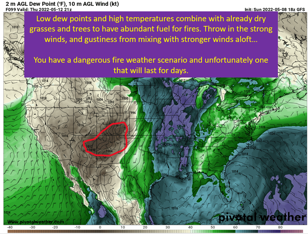
This creates strong winds across Arizona, Colorado, New Mexico, and parts of the Texas Panhandle. Combined with low dew points and already dry fuels thanks to drought, and this will produce a long lasting fire weather scenario.
Amplified Upper Level Pattern – Nothing Moves

The weather across the United States this week is going to be defined by this trough, ridge, trough pattern. The cutoff upper low over the Atlantic (covered up by the text box) gets tucked under the big ridge in the center of the country. This is famously stubborn pattern, and it holds up everything upstream. Thus out west, it just means the trough over the Pacific and Great Basin will just amplify as the ridge downstream does.
This trough positioning will favor the formation of a surface low off to the east of the Front Range. That is a favorable position for low formation in general, just off the lee side of the Rockies. Unsurprisingly, a surface low will form in eastern Colorado. The low pressure kicks up the surface winds and sets the stage for the long fused fire weather to come.
Flow Out Of Southwest Brings Arid Airmass

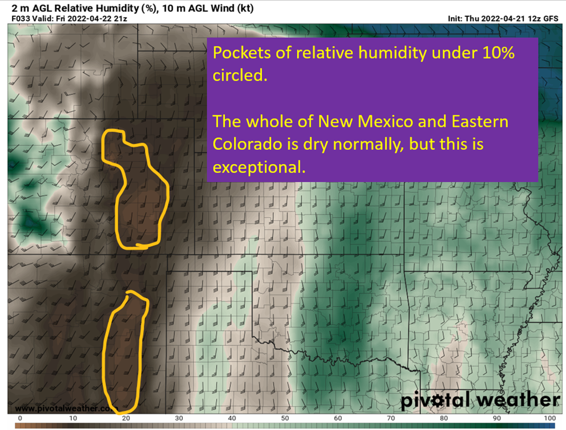
With the surface low strengthening the winds at the surface, there will also be very dry air being transported in from the west and southwest. In addition, that airmass is getting pulled over higher terrain and sinking down the other side. By Thursday, there are incredibly low dew points in New Mexico and Colorado. Dew points in the negative teens will be widespread across northern New Mexico and southern Colorado. That will be coupled with surface temperatures in the 80s to produce single digit relative humidities.
Warm, dry, and windy is the recipe for critical fire weather.
Mid Level Winds Mix To The Surface

Another thing I look at is the 700 mb winds. This level will tend to be part of the so called “mixed layer” that results from daytime heating convecting and mixing with the layers above the surface. The strong winds at this level suggest gusty winds throughout the day Wednesday and somewhat into Thursday. The gusty winds increase the fire danger and specifically the danger of extreme fire behavior. This will not be as big of a concern across NM and CO on Tuesday, but certainly will be for Arizona. Wednesday, as you can see above, no one gets a break from the gusty winds. This axis of strong midlevel winds do shift east somewhat by Thursday, but CO and NM will remain in the crosshairs.
tl;dr version
This grueling period of severe fire weather began on Sunday and will continue through Thursday across AZ, NM, and CO. As of this writing on Sunday evening, there are numerous wildfires already ongoing in New Mexico.
That is just the beginning of days of high risk fire weather. The most severe threats will shift day to day, but there won’t be a single day until Friday at the earliest that AZ, NM, and CO won’t have fire weather risk. Remember y’all, fire weather is severe weather! There’s no such thing as a “weak” fire. If a fire comes for your property, it’s likely going to leave nothing but ash behind. Making it more frightening is how fast these fires can move when the winds are strong.
I’m hoping for the best out there, but this is a scary scenario for anybody in the region.
That’s all for today. This week I will be talking about some subtropical storm potential for the Carolinas. Additionally looking ahead for this pattern to break and get more seasonable weather. I will also do a quick rundown of models that I will use during hurricane season. Discuss some biases with the major global models and the best of the hurricane models to use.