Rain Chances Return For The End Of The Week
The heat will begin to moderate (some…it’s still gonna be hot) by the end of the week. The upper level trough in the west begins to finally migrate east while an upper low off the Florida and Georgia coasts moves back to the west. Ridge gets squeezed between the two features and starts to erode. This provides some additional modest forcing for ascent. It isn’t much, but combined with an increase in surface convergence and instability from daytime heating and scattered storms become likely by Thursday. Should see an ebb and flow to the rain chances between 30-50% through the weekend.
Storms will be moving slowly, bringing flash flooding potential. In addition, gusty winds are possible with the dry air aloft. Shouldn’t yield much in the way of severe weather but worth being aware of.
Upper Level Squeeze Play

Upper low near the east coast retrogrades to the west by Thursday, with a maybe subtropical storm coming with it. GFS shows a closed off low, might be enough to get a name. It won’t have much of an effect other than to bring rain and some high surf to the Atlantic coast. Into the Southeast, this feature will end up helping to break down the ridge that has dominated the weather since the weekend. Out west, a potent shortwave ejects to the east. This brings a fairly widespread severe threat to the northern Plains. In addition, it also starts to break down the ridge that has dominated our weather.
This isn’t going to moderate temperatures all that much, unfortunately, but will increase the cloud cover and rain chances. At least the rain chances will increase somewhere along the Gulf Coast. Farther north into Arkansas and Dallas, for example, rain chances will remain meager on Thursday.
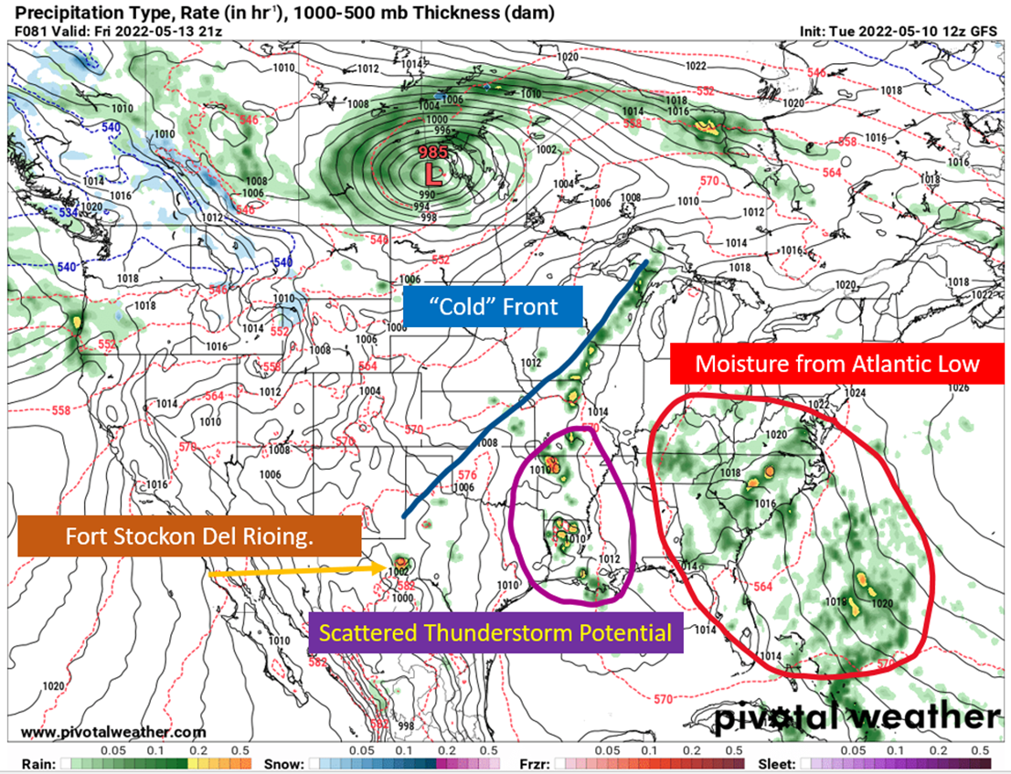
Louisiana Likely Gets Storms Thursday

In between the upper lows, some surface convergence gets induced by Thursday afternoon. It is also getting to be sea/lake breeze season, which will provide a surface boundary that helps storms to fire as well. Precipitable water over the Gulf Coast should be in the 1.5″ range, providing enough moisture for storms that fire along the surface boundary. Going to be summerlike, with slow storm motions potentially leading to some nuisance flash flooding and gusty winds possible.
Friday Brings Georgia, Alabama + Arkansas (maybe) Into The Rain
On Friday, moisture associated with the surface low off the Atlantic coast will slide inland and bring scattered showers to Georgia and the Carolinas. Some of that may extend into eastern portions of Alabama. On the west side, there are substantial differences in rainfall depiction between the GFS and Euro. Given the height falls that will be ongoing, I tend to think the European is underdoing the rain for Arkansas and Louisiana. There’s not going to be substantial forcing for rising air, but with daytime heating I’d think enough instability will be there to produce scattered thunderstorms.
Southeast Louisiana over to the Panhandle would appear to have slightly less of a chance on Friday, but don’t sleep on some seabreeze boundaries providing a spark. It just doesn’t look like there will be as much moisture available as there will be on Thursday.

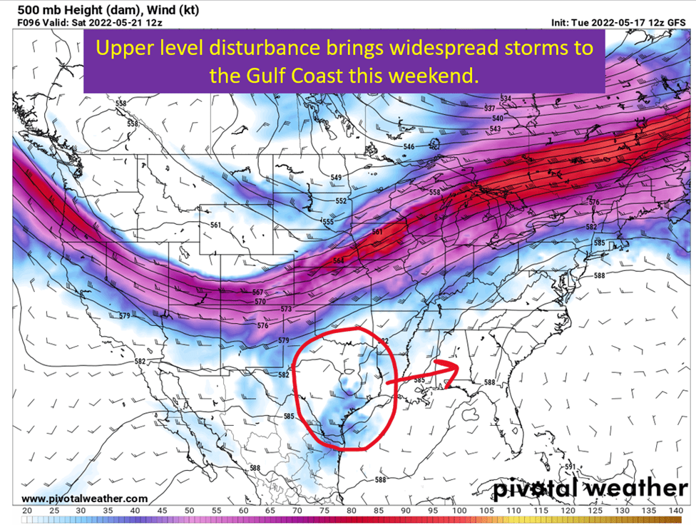
Into The Weekend: Summer Style Storms
For the weekend, it will be that classic summertime pattern of scattered afternoon thunderstorms across many parts of the Southeast. Low shear will leave storms going mostly straight up and down, and moving slowly. Low shear doesn’t mean they can’t be strong storms though. With the summerlike heat, there will be amble instability for those storms to feed off of. Plus heights will be falling across the region, which too suggests increased storm potential. These storms and the extra cloud cover should at least take the top end off the heat. Looking for highs more or less in the upper 80s vs the widespread 90s.
Don’t get too used to that though, because the heat turns back up early next week.
tl;dr version
The ridge backs off and the lack of sinking in the atmosphere allows rain chances to pick up by Thursday. Severe storms appear unlikely at the time of writing due to the lack of shear. Still, with plenty of instability, expect some storms to be strong. Coverage should be scattered across Louisiana, Arkansas, and Mississippi on Thursday and Friday. All of the Southeast should get into the scattered storms by Saturday and Sunday. This will also serve to keep things a few degrees cooler between rain chances and additional cloud cover.
Never fear though, moisture should get swept out to start next week and the heat returns.