
Memorial Day Forecast and Getting Back In The Swing
Surprise surprise, moving isn’t a whole lot of fun. Still getting the last bits unpacked but life is getting settled in. Good thing it wasn’t an active weather period over the Southeast over the last week or anything. Phantom Hurricane never happened, a different system almost went tropical and it rained for days.
Today, going to keep it simple looking ahead to the Memorial Day weekend weather across the Southeast.
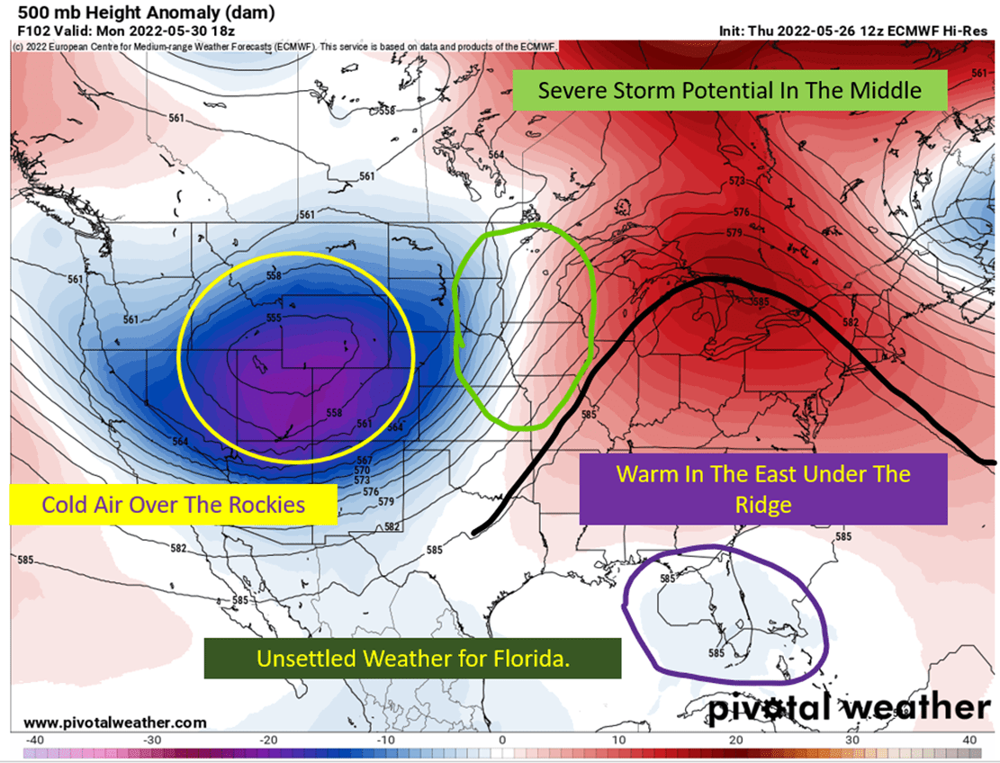
Memorial Day Weekend – East Ridge/West Trough
The big picture is it will be cold in the west, warm in the east, and some severe storm potential for the upper Midwest come Memorial Day. The Florida peninsula will likely see showers/thunderstorms with daytime heating but the rest of the Southeast should remain dry for the extended weekend.
Friday Evening Into Saturday Afternoon

The east coast will remain unsettled into Saturday morning as a storm system shifts out toward the open Atlantic. Down in the Southeast, high pressure begins to take over as the ridging starts to build into Saturday. Should be a fine day to travel in the regions. Some afternoon storms over near Panama City/Destin are possible and the Florida peninsula will have afternoon storms through the long weekend.
Expect highs to be seasonal, in the mid 80s to low 90s with mostly sunny skies for the rest of the region.
Saturday Evening Through Sunday Afternoon
Shaping up to be a perfect weekend across the Southeast. Some isolated showers are possible over in Alabama and the Florida Panhandle. Otherwise expect sunny skies and highs in the upper 80s to mid 90s. Additionally, the surf forecast is looking benign this weekend as well. NWS Mobile has the rip current severity dropping into the weekend. Check them out if you’re at the beach this weekend to be up to date on the rip current forecast.

Sunday Evening Through Monday Afternoon
I’m going to be a broken record here, but it looks very much the same to Sunday. Highs should be in the mid 80s to mid 90s across the region. Rain isn’t a significant concern but could see some very isolated showers. Keep the sunscreen nearby as the high sun angle of late May will burn you with the quickness. So enjoy the day!
tl;dr version
Picture perfect weekend coming up for most of the southeast. It will be hot in Texas, and pleasant for late May farther to the east. Storms should be isolated at most over the region, with ridging aloft not allowing convection to get firing. Rip current forecast looks to have benign surf conditions for the beaches this weekend. So get out and enjoy the long weekend. Or just enjoy it from home. As long as you enjoy it.