
Danielle and Earl First Storms In Atlantic In Two Months
The first hurricane of the season, Danielle, took until September 1st to even form. This meant August went without a single tropical system in the Atlantic for the first time in twenty-five years. In addition, Danielle formed near 38 N, deep in the subtropics, where the shear is lower and the water unusually warm.

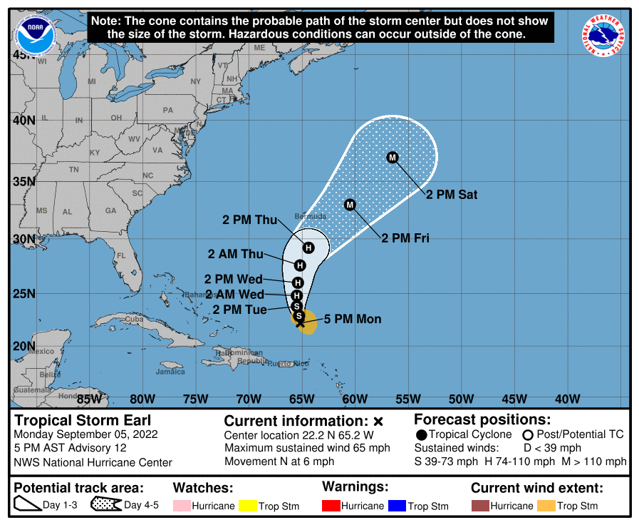
Back to where hurricanes are supposed to form, we have Tropical Storm Earl spinning north of the Greater Antilles. Shear is still hitting Earl, and keeping it from picking up much strength. This is despite deep sustained convection over the center. Just remember, you’ll often see a dense blob of convection in the face of moderate shear and storms will just not organize despite all the heat being released. I think that’s the case for the short term, but outflow is already improving and will continue to improve. We might see Earl become a hurricane as it turns to the NE away from any landmass but Bermuda.

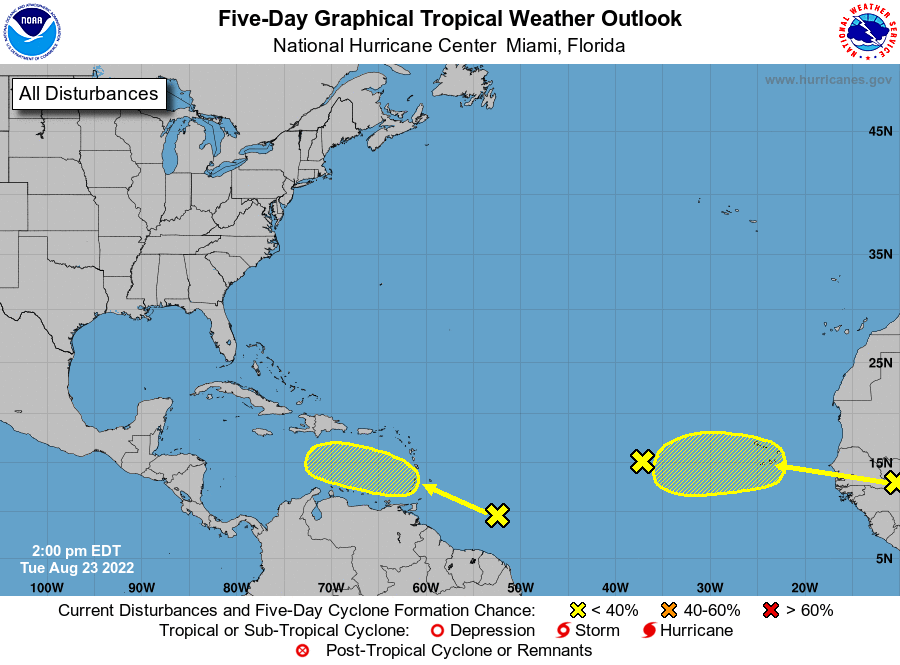
Outside of these two systems, things should break more hostile in the deep tropics over the next two weeks. Possibly leaving yet another period of quiet, despite the continued favorable tropical forcing. Today, let’s take a look at the futures of Danielle and Earl and try to figure out if there’s going to be anything following these two storms.
Danielle Will Slowly Fade As It Moves Toward Europe

Yes, the subtropics are unusually warm but the heat content still gets meager as you move Northeast across the ocean. This will cause Danielle to slowly weaken and transition to extratropical by the end of the work week. Nothing really interesting here, other than how far north Danielle is. The more interesting storm is Earl, which is forecast to be the first major hurricane of the season by this weekend.
Tropical Storm Earl To Get Outflow Enhancement From Jet Streak

This will certainly goose those ACE numbers for the season, as Earl should be a long lived storm as it moves NNE across the Atlantic Ocean. The key for Earl is the upper levels are going to helpful, for once this year, and allow the outflow to absolutely crank. When I see the upper levels venting a storm like that, I begin to expect a major hurricane is coming. The NHC agrees, forecasting Earl to become a Category 3 storm by the weekend.
The good news is that only Bremuda is at any risk from Earl, and Earl is currently expected to go safely east of the island. Also, this should eventually yield an impressive extratropical transition once it gets farther north by next week.

Tropics To Go Hostile Over The Next Week, But Shear Potentially Drops By The Second Half Of September

The next week looks to be dominate by upper level troughs cutting through the subtropics. This brings shear and transports dry air in from the north. There is wave coming off of Africa currently that could find a window for slow development, but it is not until the middle of the month that ensembles start picking up on activity. This is in response to the shear dropping over the main development region (see the gif above). This is the next period to watch, starting somewhere around September 15th.

tl;dr version
There are two storms out in the Atlantic, and none of them are a threat to land. There’s Danielle, in the northern Atlantic that will slowly decay as the work week goes on and eventually become extratropical by Thursday or Friday. The more interesting storm, Earl, should become a major hurricane by the weekend thanks to a favorable jet stream interaction. After that, I’ll be watching for Fiona to form off the wave that is currently coming off Africa. There isn’t support for much more than a tropical storm though.
After that, things should be quiet until about the 15th of the month. Ensembles are showing activity around this time, and makes sense with projections of a ridge building over most of the Atlantic and shear dropping.
Now, I need to give a word of caution. That typhoon is going to recurve into the mid-latitudes and that makes projections in the 10 day timeframe of low confidence.
That’s all for today. There’s nothing threatening the Gulf of Mexico for two weeks. Just going to watch trends going into the end of the month.
Related Posts

Hurricane Season 2023 Preview: El Nino Returns
Tropical Storm Ian Churns in Caribbean As Models Shift West
It’s Officially TD9, And The Models Are Targeting Florida
98-L: The Model Madness Continues
Getting To Know The Steering Players For Future Hermine
Y’all Need To Pay Attention To The Next Wave
Expecting Danielle By The Weekend. Otherwise, Shear and Dry Air Dominate.
Still Watching Caribbean For Tropical Development
Watching The Caribbean For Tropical Trouble
