Hope You’ve Enjoyed Fall So Far. Looking Ahead At The Big Picture Into November.

So I’ve been off in Utah, taking in some fall color and catching some early season snow.
Back in GumboWx land, the weather has been pretty benign (this weekend not so much though). Drought has dominated the weather news in the east, with the Mississippi River running at or near record lows up and down the length of the Big Muddy.
This dry pattern is probably going to continue for a couple of more weeks, but there appears to be a real chance at it feeling nice and crisp for y’all at Thanksgiving. Today, I’m going to follow the logic of Eric Webb in why there will be a Greenland block to end the month of November. That block can mean cold air getting bottled up in the eastern United States and lets it dive far into the south.
Well…assuming the Pacific lines up right.
What Is A -NAO Anyhow?

I know! I know! Image is a little busy.
That’s why I want you to ignore most of it. Just look at the temperatures off the US East Coast.
Positive phase = warmer Eastern United States
Negative phase = cooler Eastern United States
I’ll give you NOAA’s more technical definition at the end, but here’s the general idea:
A negative NAO (-NAO or negative North Atlantic Oscillation), is when you get a ridge over Greenland at the 500 mb level. This ends up acting as a “block”, not allowing colder air from the continent to just keep flowing around the pole. Instead, it stops traffic and can force colder air down south. It doesn’t mean there WILL BE cold air, just that you increase the odds.
Strong positive phases of the NAO tend to be associated with above-normal temperatures in the eastern United States and across northern Europe and below-normal temperatures in Greenland and oftentimes across southern Europe and the Middle East. They are also associated with above-normal precipitation over northern Europe and Scandinavia and below-normal precipitation over southern and central Europe. Opposite patterns of temperature and precipitation anomalies are typically observed during strong negative phases of the NAO.
Source: NOAA
Ok. Got It. So Why Do You (And This Eric Guy) Think This Will Be In Place For Late November?
Don’t feel obligated to understand all of this. Hell, I’m not sure how strong my handle of the details actually are. The story he lays out makes a whole lot of sense though, big picture, which is enough for me to want to share it with you.
All the images below were produced by Eric Webb.

Again, don’t worry about “Mountain Torque” if it means little to you. Here’s the simplified story:
- There’s a ridge over Scandinavia. This leads to flow across the north pole and cold air being pushed into Russia.
- When you get a big push of cold air at the surface, there tends to be a high pressure with it. In this case, it takes the Siberian High and strengthens it and has it sag farther south into Russia. This is like middle of the month of November.
- The cold airmass continues to push east, toward China in the week following. This leads to an increase in that mountain torque.
- What matters is that increase in mountain torque and hot/cold airmasses meeting near the polar jet stream in the Pacific lead to a trough over the Aleutian Islands (research supports this idea)

His post was meant for someone with, at the very least, my level of met background. What is “useful” (how useful a month out timeframe is…well dubious) is seeing that abundant research indicates all of this should work together to yield a persistent ridge over Greenland near the end of November.
Short Term: Hurricane Lisa Remnants Brings Rain Saturday

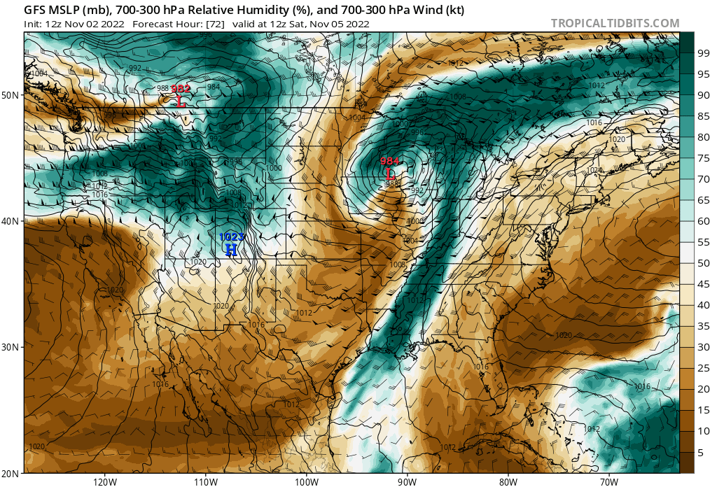
There isn’t much to this but to enhance rainfall along the cold front coming this weekend. Hurricane Lisa’s leftovers will likely get pulled up toward the large storm system over the middle of the country this weekend. With the big college football games this weekend, those tailgating should keep an eye on the local forecast to your area. It won’t be tropical winds or anything with it, just some extra moisture that gets drawn out of the southern Gulf of Mexico. It’ll give a little extra kick to the rainfall rates, that’s all.
tl;dr version
November will start warm for the southeast, as ridging should mostly stay in place for the next two weeks or so. After that, things should trend colder for the southeast. In addition, by the end of November, a blocking pattern should emerge over Greenland that tends to keep the eastern United States locked into a colder pattern. How cold, and even potential frozen precip chances in December will depend on how the Pacific pattern evolves. It’s just time we switch from tropical and get back to the mid-lats.
In addition, this weekend will see a cold front move through the southeast and rain chances come in Saturday along with it. The system will be able to tap leftover moisture from Hurricane Lisa’s remains, and could see some locally heavy rainfall/flash flooding due to it. Y’all do need the rain though.

