Did you miss the 90s? I’ve got good news!
The Rundown
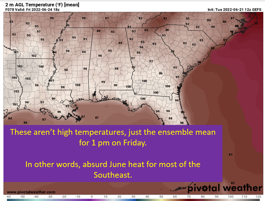
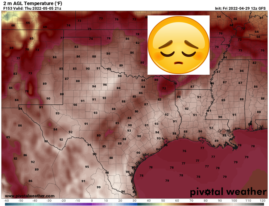
It’s about to get hot.
Sigh.
It’s about to be May, and with that comes the mother nature cranking the thermostat up. The storm threats move farther north, the cold fronts don’t come as frequently, and the sun angle just keeps getting higher. The humidity should at least be a little below full summer misery, but it’s still going to be muggy with temperatures getting into the 90s by the end of the week and next weekend.

Ridging Dominates Most Of The Week
The main player for the week ahead is going to be high pressure parked near the Bahamas. This keeps flow coming off the Gulf of Mexico for the Southeast. It also will tend to keep rain chances and clouds limited, letting the sun do it’s thing and heating the ground. The influence of this high pressure system will be at it’s strongest Wednesday and Thursday, at least that’s what it looks like right now. Expect temperatures in the low 90s across most locations in the Southeast.

Upper Levels Support The Midweek Heat
We’re going to go between “zonal” west to east flow aloft to some upper ridging by mid-week. As the upper ridging takes hold, we’ll see the temperatures rise into the 90s with the help of a bit of sinking air and the lack of cloud cover. By the weekend, this will flatten back out and present some opportunities for rain. Still uncertain if it’ll be much cooler though. Could easily see 90s remaining through the weekend with summer starting to flex a little more.

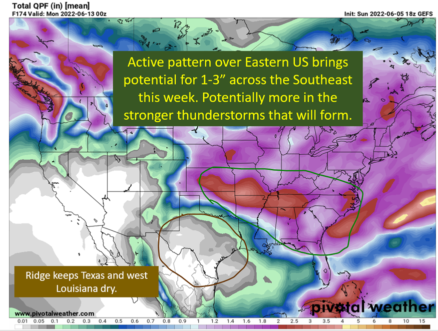
The Tennessee Valley is Going To Get Some Rain
Down closer to the Gulf Coast, rain is going to be hard to come by with high pressure in control. If you look farther north though, getting into Arkansas, Tennessee, and Kentucky there will be ample rain chances for most of the coming week. The pattern up at the jet stream level keeps divergence overhead for this region. Additionally, it is where the best thermal gradient at the ground level will be setting up. That confluence at the surface helps provide a focus for rain and storms. Furthermore, the tracks of the upper and mid level disturbances will be tracking close enough to the region to provide lift.
All of this works together to present a week of heavy rain across this region.

tl;dr version
Summer makes it’s first flex next week, with temperatures easily getting into the 90s across much of the Southeast and it just might hold on through the weekend. Rain chances to the south will be meager until Friday at the earliest. Farther north, for the I40 corridor, rain chances will be frequent with Oklahoma getting multiple rounds of severe weather and some potential for severe weather to the east of OK. Even if there isn’t much severe across the Tennessee Valley, there will be rain.
I do need to add, down in the south, we will have to watch for convective complexes diving south from the rainy region as the week goes on. Those aren’t going to show up in modeling at this point but could happen. Just saying, don’t be totally surprised if some strong storms come rumbling south at some point next week.