
Pattern Change Is Coming For The End Of May
The Rundown
A Convectively Coupled Kelvin Wave (CCKW) will be making it’s way across the Pacific this week. It will have impacts on the potential tropical storm we’re watching. It will also break the current pattern over the United States. This will bring back severe potential in the Plains, bring temps closer to normal in the Southeast, and generally get things looking a lot more typical of late May. So, for the middle of the week, I’m going to be talking about pieces are going to be shifting and what that means for weather across the country.
It’s Time To Dislodge The Gulf of Alaska Low

Most of last week, we had a trough in the Gulf of Alaska with ridging out over the center of the country. This has produced extreme fire weather in New Mexico, record tying to breaking heat across the Southeast and Texas, and shut down the threat of severe weather across the Plains. That upper low is going to be dislodged this week, and shift to the east across the western United States and eventually into the Plains by next week. This will usher in the return of severe season in the Plains as well as likely dropping the temperatures in the Southeast a few degrees.
The unfortunate news is that it doesn’t look to bring much relief to the drought in the Western US and fire weather will remain a concern.

The CCKW Will Force The Change
This is a term that comes up with the tropics most often, as the passage of a CCKW will often cause better conditions for tropical cyclone formation. It might just do that this week down near Costa Rica but the extra momentum it is bringing across the entire Pacific is going to get things moving across the Northern Hemisphere. Jet stream will begin to get wavy and have bigger dips across the CONUS. Subtropical jet stays in place to keep shear over the Gulf. In general, what you’d expect to see this time of year vs the jet stream being stuck farther north.
Also, pay no attention to the strength of the low pressure in the Gulf on the upcoming image.

Quick reminder, that’s an operational run for about a week from now. Don’t take the placement of anything as certain, I’m just trying to drive home the general idea.
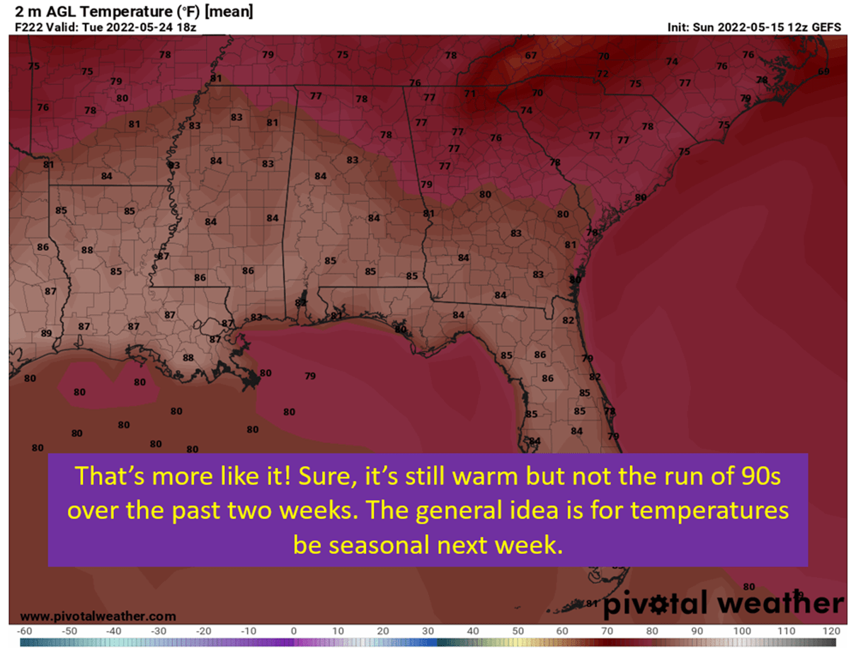
Temperatures Across The Southeast
So far there’s a lot of talk about other parts of the country. What does all this mean for areas closer to home? Good news everyone! Temperatures should become seasonable by next week, with highs in the upper 80s vs the low 90s. Enjoy this respite, because we all know the heart of summer is just around the corner.

tl;dr version
Things are about to get back to normal for May. Most places at least. The upper level pattern is going to be a boot in the behind, and get things moving around. This results in severe potential returning to the Plains, along with temperatures moderating in the Southeast. Will have to keep watching the tropics for a potential Alex, but it is hard to get worked up over a potential May tropical system. I’ve seen some very warm temperatures coming for California by next week, which isn’t good with fire season getting starting. Other than that, should have our typical May weather to end the month.