The Thermostat Turns Up More and Sneaky Tropical Potential.
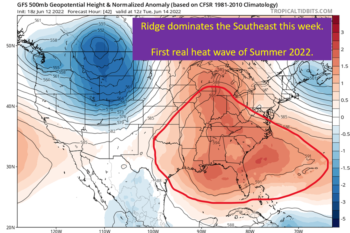
This summer being two weeks ahead of normal continues with a strong ridge building over the south and middle of the country. The main story is going to be how hot things are going to get in the Southeast. Temperatures will run 5-10+ degrees above normal for all of SEC country this coming week. In addition, Eric Webb made a good point on Twitter Thursday. It is worth watching for any mesoscale convective complexes (MCS) that move over the open water and then get trapped under a building ridge. Low probability event for sure, but still worth keeping an eye on.
Blowtorch Intensifies This Week
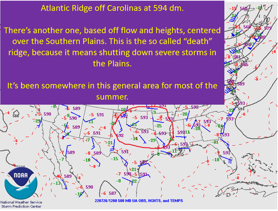
The big story of the week is going to be the heat with a look more akin to the heart of summer. Unusually strong ridging across the southeastern United States will threaten temperature records. This ridging will build west over the course of the week, bringing a brutal batch of heat across the south of the entire country. 500 mb heights will be in the 594 dm neighborhood, which is well within the torch range for that measure.

July Style Summer Misery Incoming

Summer explodes over the Southeast with widespread mid to upper 90s across the Southeast. Texas should see another week of widespread 100+ degree days as well. The upper level ridging makes me skeptical of the widespread storms the GFS is showing on Tuesday. That said, disturbances going around the larger ridge will probably fire off a couple of nasty mesoscale convective complexes (MCS) next week. Question would be where they would end up and when.
Overall though, HOT!
Dew Points Build Through The Week. Dangerous Heat Indices Expected.

Temperatures soaring into the mid to upper 90s with dew points in the mid 70s will put heat index values into the heat advisory range for most locations by the end of the week. Expect those heat index values to be in the 103-108 range through the week. This means taking precautions if you’re going to be spending time exerting yourself outside. Take plenty of breaks. Drink plenty of water. The usual stuff that applies during heat waves.
Also, make sure your pets have a cool place to go during the day and access to plenty of water as well!
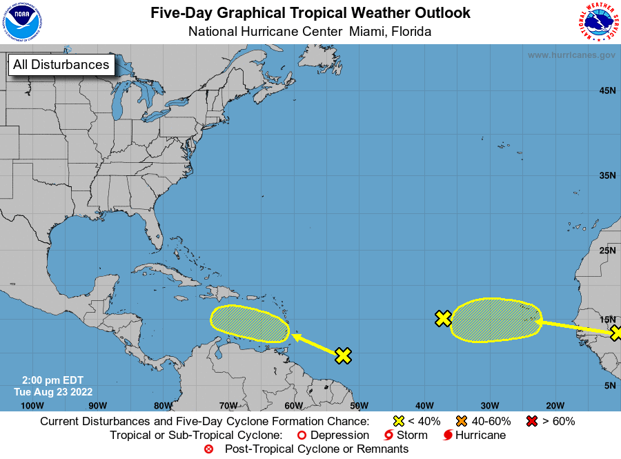
Low Probability Tropical Potential
This is a low probability scenario.
There is potential; however, for an MCS to develop with the help of shortwave disturbances going clockwise around the large ridge over the eastern United States. If a cluster of storms like that were to get out over the open water of the Atlantic, it could develop tropical characteristics as it continues around the ridge across Florida and into the Gulf of Mexico. This is a scenario like what spawned Hurricane Barry in 2019.
Again, this is a low probability scenario.
It is just one that is hard to predict very far in advance.
Easterly Flow By End Of Week Will Increase Rain Chances
Let’s say the more likely happens and nothing tropical comes from this pattern, the easterly flow will bring some increased rain chances along the Gulf Coast by the end of the week. It will, of course, come at the cost of increased humidity but this flow regime would allow undeveloped tropical waves to be pushed across the Gulf. They wouldn’t go tropical, just increase the rain potential. This is more of a this weekend concern with the increase in rain chances, early week is just going to be roasting.
tl;dr version

The first heatwave of summer is on this week. Expect temperatures to soar into the mid 90s or higher all week, with humidity increasing in most locations as the week goes on. This will bring widespread heat indices of 105+ across the Southeast. This means, if you’re going to be spending time outside, take plenty of breaks and drink plenty of water. The oppressive high sun angles of June are only going to make it worse. Take extra care of that outdoor activity has you in the sun all day.
Rain chances will likely increases with the humidity through the week, with chances showing back up mainly by the weekend for most of the Gulf Coast. Could see storms earlier in the Carolinas, Georgia, and Florida. In addition, there’s a low probability scenario where a tropical storm forms from a convective complex that moves off the east coast. It would eventually end up in the Gulf with this steering.
Nothing to lose sleep over right now, just mentioning it is possible. That doesn’t mean EXPECT it!
Be safe out there in the heat, and I’ll be back later this week to discuss whatever strikes my fancy by then.
Related Posts
Tropical Storm Ian Churns in Caribbean As Models Shift West
It’s Officially TD9, And The Models Are Targeting Florida
98-L: The Model Madness Continues
Getting To Know The Steering Players For Future Hermine
Danielle and Earl First Storms In Atlantic In Two Months
Still Watching Caribbean For Tropical Development
Watching The Caribbean For Tropical Trouble

The Tropics Appear Quiet For Next Couple of Weeks
A Brief Cooldown In The Southeast And Watching The Tropics