Tropics Shutting Down For The Remainder Of July
To start off with, sorry I have not been as active lately. Between the toddler and other responsibilities up here, I haven’t had the same time to dedicate to forecasting. This will hopefully improve as the summer goes on.
The Rundown
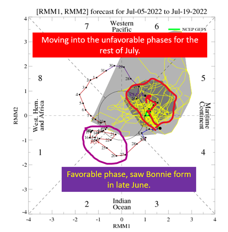
The big picture is that things like CCKWs and the Madden Julian Oscillation (MJO) won’t be in place until early August to support tropical systems across the Atlantic basin. The MJO will be back in a favorable position for the Atlantic (Phase 1+2) by August, so enjoy a month of not having to worry much about the tropics. A lull in July is typical of most seasons, with only 2005 having a substantial amount of July hurricane activity in the Atlantic.
Today, I’m going to do a quick rundown of what the MJO is and what phases are favorable for tropical formation. The gist is we are heading toward the unfavorable phases.

The Madden Julian Oscillation: Enhancing Convection Around The Round Every 40* Days
*It’s more like 30-60 days
The Madden Julian Oscillation (MJO) is the most important subseasonal (timescales of weeks to 2 months, vs 6 months of a tropical season) feature that meteorologists consider when doing the longer range tropical forecasts. I’m going to yada yada over a lot of the details, because I’m already getting hammered on readability and getting more technical isn’t going to help. Plus, I’m not sure how helpful it would be for the average user of this blog.
What you need to know is the MJO is a wave that circles the earth moving west to east that enhances thunderstorm activity in some areas and suppresses thunderstorm activity in others. Where those areas are depend on where the wave is. We break the globe down into eight regions (the eight phases) and certain phases favor tropical storms in the Atlantic (1 and 2). Others will favor the Pacific and generally keep a lid on the Atlantic (6 and 7).

The MJO Is Currently Phase 4 – Tracking Toward 5 and 6
We’re in the transition phases between the active and not active, which in the heart of the season could yield something but right now means the Atlantic should stay quiet for the next three to four weeks. The environment will continue to degrade for tropical systems as we get into the middle and near the end of July. So great news! The calm before the heart of the season is here. The bad news is, at some point in August, the MJO will be supportive of hurricanes in the Atlantic.

A Result of The MJO Placement: Higher Shear Across The Atlantic

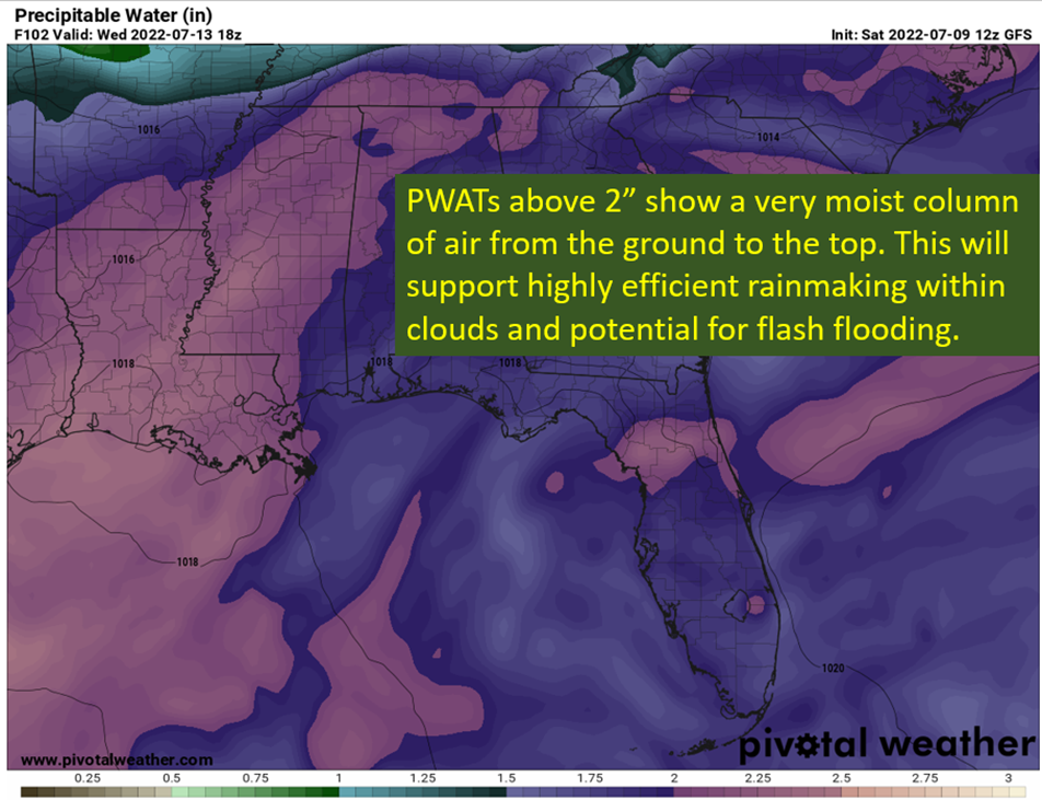
The suppressed phase brings wind anomolies at the low levels and the high levels in a way that increases the wind shear. Most of the Caribbean and MDR are sitting under anomalously high shear by the middle of the month. The only region that isn’t above normal is the East Caribbean, famous for its high shear in general. In addition, suppression toward Africa will slow the the easterly wave train down. All together, fewer waves + more shear means few opportunities for tropical systems for the next three plus weeks.
tl;dr version
Despite warmer than normal water temps and a favorable seasonal background, the tropics are about to shut down for July. The MJO will continue to move into a position to keep convection suppressed over the Atlantic for the rest of the month. What that means is a tendency to have air sinking over the basin, and also increase the shear over the MDR. Put it together, fewer waves and more hostility for those waves. So, enjoy the break from tropical worries because the MJO will turn friendly for hurricanes at some point in August.
Related Posts
Tropical Storm Ian Churns in Caribbean As Models Shift West
It’s Officially TD9, And The Models Are Targeting Florida
98-L: The Model Madness Continues
Getting To Know The Steering Players For Future Hermine
Danielle and Earl First Storms In Atlantic In Two Months
Still Watching Caribbean For Tropical Development
Watching The Caribbean For Tropical Trouble

The Tropics Appear Quiet For Next Couple of Weeks
A Brief Cooldown In The Southeast And Watching The Tropics