
Getting To Know The Steering Players For Future Hermine
I enjoyed a nice morning of playing with my daughter and reading the internet to see folks watching model runs come back with rapt attention.
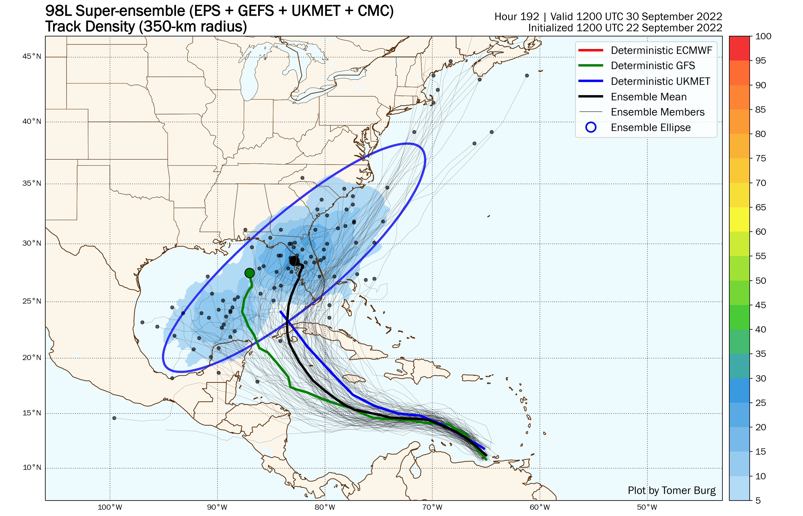
That’s a good way to make yourself crazy, because there is too much uncertainty to get an exact landfall answer correct at this point. What is worth seeing; however, are the features that will end up steering the system. Seeing this will give you a good idea of why there is so much uncertainty in the short range forecast, why it is going to be very difficult to miss that north turn in the NW Caribbean, and why it will end up mattering where the storm is when the north turn starts.
Today, I’m going to look at three players that are going to play a role in the track of 98-L. The first two are the cause of Caribbean uncertainty, the last is the almost certainty of the turn north.

Part 1: Outflow From Fiona Could Push 98-L More Southwest in Near Term
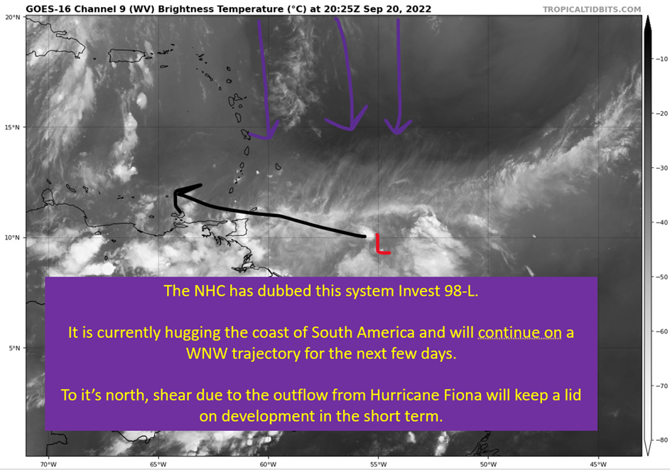
Dr. Levi Cowan mentioned this in his Tropical Tidbit today, but that shear from Fiona’s outflow I mentioned yesterday might also nudge 98-L farther south or even southwest in the near term. This is a big piece of the short term uncertainty, as these nudges could mean 98-L forms closer to Nicaragua or they might not mean much and it ends up closer to Jamaica at formation.
Well, in part with the general uncertainty of not having a formal center of circulation yet.
Once 98-L gets to the center of the Caribbean and there’s an actual center of circulation to track, I expect to have the track basically locked in. The trough that’s going to open up the door north isn’t exactly going to be subtle. Where it launches north from is going matter, with SE Louisiana to The Florida Keys being a reasonable range of outcomes at this point with the uncertainty currently.

Part 2: Subtle Upper Low In NW Caribbean Could Nudge 98L North near Cuba
This is an interesting point and while it won’t make a huge difference, a little nudge N to NW south of Cuba would probably be enough to get Louisiana off the table. This is pretty subtle stuff, and if it is farther SW it might miss the nudge all together. This isn’t an all clear, but it is another piece of the puzzle that leads me to this conclusion.
A landfall on the west coast of Florida is the most likely outcome here.
Louisiana over to Gulf Shores should still keep a close eye on this. I’m not trying to “all clear” the north Gulf Coast. It is still a reasonable scenario to get something far enough SW to miss the hard turn toward Florida and get drawn north toward Louisiana, Mississippi, Alabama. So keep an eye on things.
It is just that, with the massive trough coming down by next week, this thing would have to be very far south to miss the pull. It also fits with what normally happens this time of year. Logic just points to a NE running system into Florida above any other scenario.

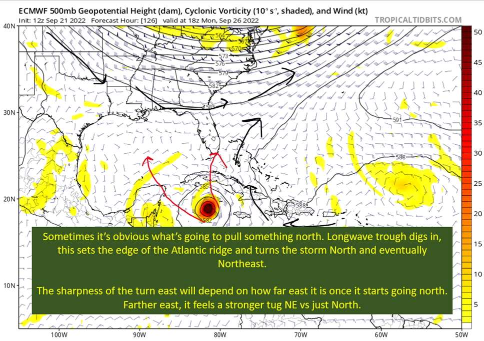
Part 3: Gigantic Longwave Trough Erodes Atlantic Ridge and Opens Door Wide Open To The North


There’s not much complicated about this part. That big trough over the eastern United States will erode the Atlantic ridge and set a western edge to it. Flow around the western edge of a ridge is from south to north. This flow will push future Hermine to the north and eventually to the Northeast as it approaches the base of the trough.
The questions left are:
- Could it be too weak and too far south to feel the tug, and then just end up continuing west?
- Where will it be when it starts the move north?
Once we have those answered, the NHC will have the path locked in.
tl;dr version
Model runs remain inconsistent, as they continue to struggle with positioning of 98-L for the next five days or so. This is due to northerly shear pushing the mid-level circulation trying to form to the south and potentially nudging the low level circulation with it. This will matter as where it ends up in five days will determine where it turns north and what part of Cuba, the Yucatan, and the United States it will directly effect. In addition, there is a subtle upper low showing up on the models that might give a slight nudge toward a Florida landfall. Finally, the obvious trough that will open the door to the north and northeast.
What matters for track will be where the center forms and where it is near Jamaica’s longitude. So don’t sweat individual model runs, have an idea what the main players are going to be to steer it, and we’ll see where it is by Saturday.
Tomorrow, I’ll dive in on the strength potential of this system and what impacts track differences would mean.
One thought on “Getting To Know The Steering Players For Future Hermine”
Comments are closed.
Related Posts
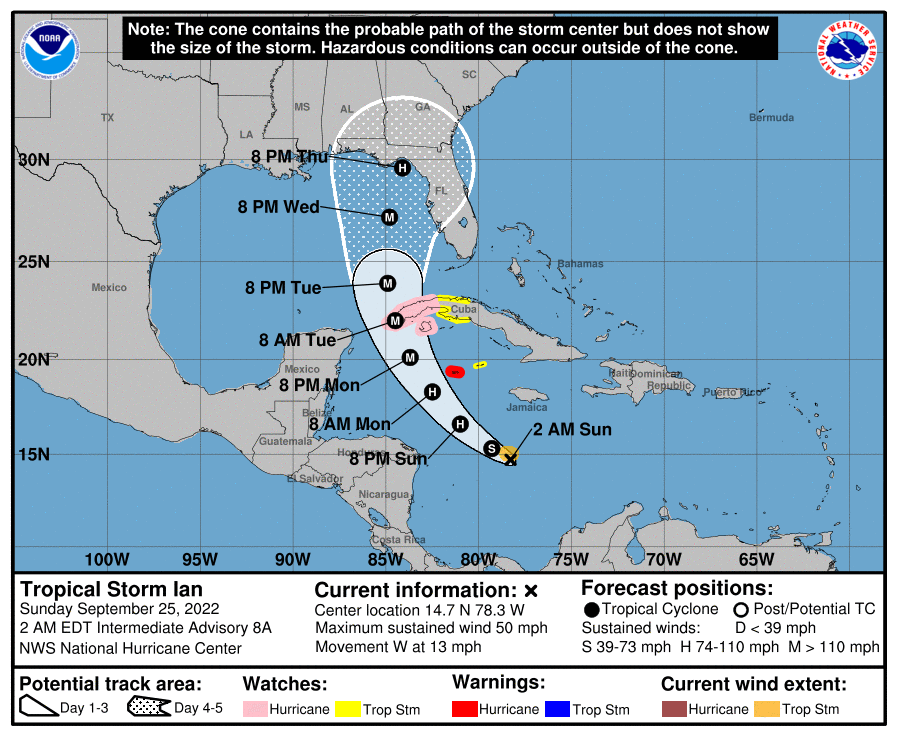
Tropical Storm Ian Churns in Caribbean As Models Shift West
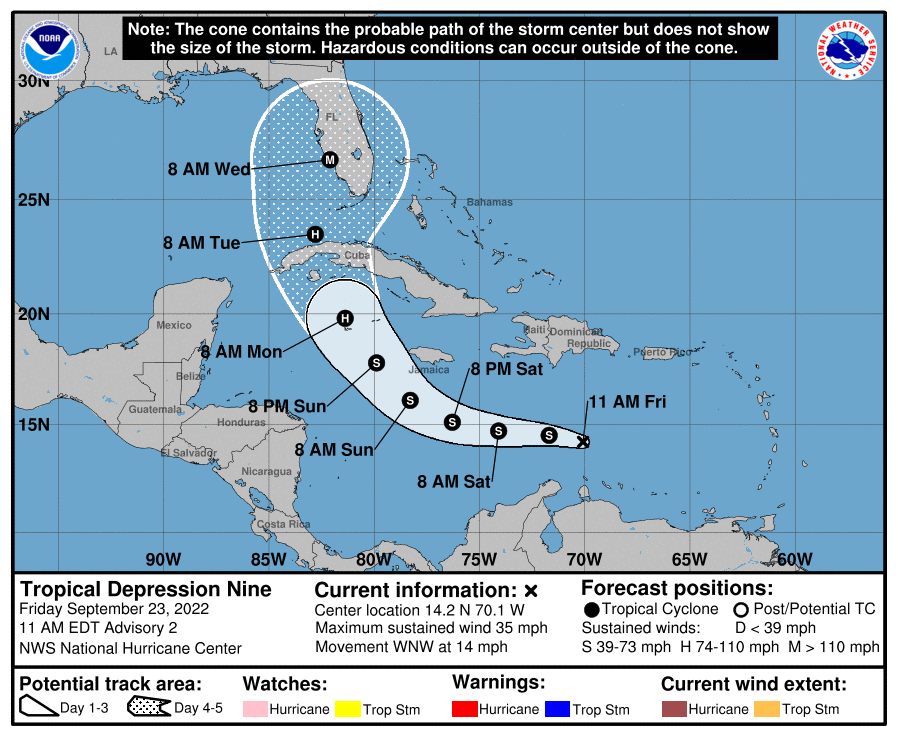
It’s Officially TD9, And The Models Are Targeting Florida
98-L: The Model Madness Continues
Invest 98-L With High Chances of Development
Danielle and Earl First Storms In Atlantic In Two Months
Still Watching Caribbean For Tropical Development
Watching The Caribbean For Tropical Trouble

The Tropics Appear Quiet For Next Couple of Weeks
A Brief Cooldown In The Southeast And Watching The Tropics
September 27, 2022 at 2:43 pm
Top site ,.. amazaing post ! Just keep the work on !