Hurricane Ian Strengthens and Grows Larger With Landfall Tomorrow
For those seeking the best information for your area: See the opening to my post yesterday.
Here I have links to the National Hurricane Center, NWS Offices, and NWS Office Twitter Accounts. They know your area’s geography far better than I do. They are extremely well trained, and will get the best information to you in a timely manor.
The Rundown
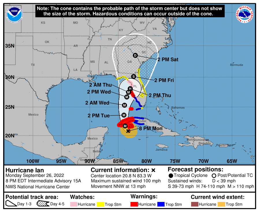
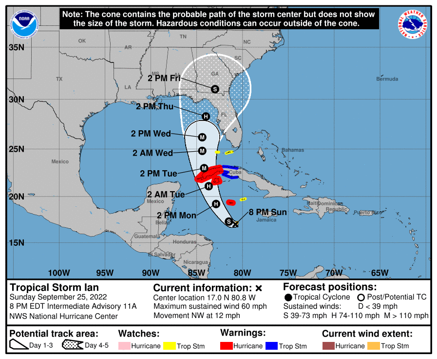
There hasn’t been much good news on the Hurricane Ian front today, but at least it has ended up deep enough to get pushed a little east. This is very likely enough to save Tampa the devastation I feared was coming last night. The region still needs to watch for ridiculous rainfall, but the 10′ of water into Tampa Bay should be off the table with the eye coming inland to the south.
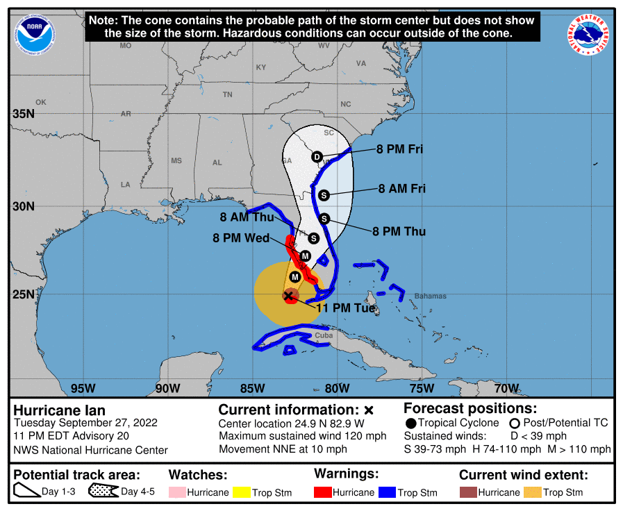
This shift has brought places like Naples, Sarasota, and Port Charlotte into the crosshairs, and just a day out from a landfall, I don’t see that changing. This region was hit by a Category 4 in 2004, Hurricane Charlie. Those trying to draw comparisons to Charlie for the region are making a huge mistake though.
Ian is a much larger storm. The maximum sustained wind won’t be as high as Charlie, but it will be bringing significantly more water with it. The surge is going to be significantly higher than Charlie. Life threatening type surge.
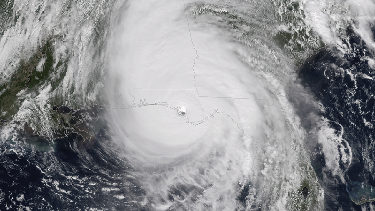
Tonight, I’m going to keep things pretty simple. There’s not much left to game out. I just want to look at the latest radar and satellite, and discuss impacts expected.

Cuba Wasn’t Even a Speedbump, But Eyewall Replacement Cycle Slowed Strengthening
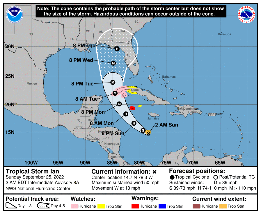
Hurricane Ian surprised the hell out of me this morning by not being slowed down AT ALL by Cuba. I didn’t think it would be too disruptive, but it didn’t effect the storm at all. Pressure kept dropping and presentation kept improving. That changed this afternoon, as Ian underwent what is known as an “Eyewall Replacement Cycle”.
What happens is an outer band becomes dominate and eventually takes over as a new eyewall and the original one decays. Once the new eyewall takes over, the storm will have expanded its wind field and will have a larger eye. This eyewall will contract over time and eventually the process would start again, assuming time over open water.

Sometimes these take about a day to cycle through. Ian did it in six hours, with the process already done. This sets the stage for strengthening ahead of landfall, increases the surge potential due to the wind field expansion, and brings more people severe impacts. I’ve seen these cycle save people when they happen right before landfall. This one did nothing but make the problems worse.
Ian Is Going To Bring A Tremendous Storm Surge
Anyone from Longboat Key South should be prepared to see life threatening storm surge, to the tune of 8-12′. A slow moving, large hurricane brings a lot of water with it and it just keeps building as the wind pushes over the same area for hours and hours.
This is the real scary part of Ian if you’re near the water and on that southside of the circulation. Hide from the wind. Run from the water.

This is going to be nothing like Hurricane Charley in terms of surge. Charlie was fast moving and extremely compact. The wind, for those who got the max, will have been higher in Charlie. The amount of water that’s coming for Charlotte Harbor will dwarf what Charlie brought. If you’re down there or know people who are, urge them not to use that as the baseline to make decisions.
Honestly anywhere near the coast, and I’m already on the road.
Freshwater Flooding Another Huge Concern But North Of The Center

The models have been consistent with a swath of near 30″ of rain across somewhere in central Florida, just along and north of the forecast path of Ian. The WPC has put out a high risk for excessive rain for tomorrow and Thursday across central Florida. This includes Tampa and Orlando. The vast majority of flood damages and deaths happen on these high risk days and unfortunately it is a near certainty somewhere in central Florida experiences catastrophic fresh water flooding.
This part is often overlooked in hurricanes, but you just have to look to Houston for Harvey to see what these tropical rains can do.
***I’m not saying this will be Harvey, the rainiest hurricane on record. Just the rainfall can be as devastating as the wind or surge.
The Expanded Wind Field = More Widespread Damage

While the larger eye does mean the extreme winds of Michael, Laura, and Ida aren’t going to be realized, you get hurricane force winds spread over a larger area. Currently those winds are extending nearly to the coast of Florida and will start coming ashore by morning. As the storm slows toward landfall, this means a long duration event of high end tropical storm to low end hurricane force winds over much of the Florida Peninsula.
It’s not going to be a fun ride, even if you’re 50 miles from the center of the storm.
We’ll Have To Talk About The East Coast of Florida, Georgia, And South Carolina
I’m going to keep this part brief tonight, but there will be impacts along the Atlantic side of things as well. Wind pulling from the east will drive surge all along the Eastern Coast of Florida and up into Georgia and South Carolina. In addition, some modeling wants to bring Ian back over open water and do another landfall into South Carolina.
Just need to keep an eye on this if you’re in those regions.
tl;dr version

Ian is getting some shear on the west side. You can see it getting pushed a little bit from that side. That’s going to be something to watch and see if that impedes strengthening any.
Anyway, Ian is expected to make landfall tomorrow along the SW Florida Coast. Along with widespread damaging winds, Ian will bring 8-12′ storm surge on the SE side of the path. In addition, on the north side, potential for 30″+ of rain and widespread freshwater flooding are expected. If you’re in any way at flood risk, I’d leave. Otherwise, listen to your local officials and local NWS office for the best information for your area.
Stay safe all.


