
March 6th Severe Threat: Arkansas and Southern Missouri
Tomorrow evening, a slight (2 out of 5 from the Storm Prediction Center) risk exists for severe weather from eastern Oklahoma into all of Arkansas and southern Missouri. I’m going to be watching the “warm” sector, where dew points will be in the mid 60s and temperatures in the 70s. This will be the area with the greatest instability by tomorrow evening and that will be where the risk for tornadoes and damaging winds are the greatest.

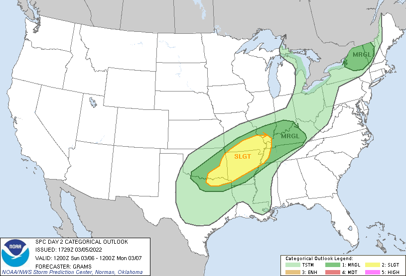
SPC Day 2 Categorical Outlook, valid 18z on 3/5/22. The Storm Prediction Center house some of the best severe meteorologists in the game, and is a vital resource when severe weather is coming.
At the synoptic scale, a shortwave trough (provides lift and shear) will eject from the four corners to the east and northeast (shown below from the 12z GFS on 3/5/22). Ahead of this, a weak surface low should form thanks to the upper level help coming with that shortwave, and a healthy temperature gradient along the northern extent of the slight risk area shown above. There will likely be two rounds of storms, with an earlier in the afternoon round that will have modest low level shear available but more instability. Then a second round of storms into the overnight, with much nastier hodographs (means lots of shear and low-level shear too). The question will be the extent of the warm air northward. Where that warm front is by evening could well provide a focus for a greater tornado risk.

12z GFS from 3/5/22, showing 500 mb vorticity and the travel of the shortwave that will provide the lift and shear for the potential severe weather tomorrow evening. Image made from the Forecast Gif maker at Tropical Tidbits. At this point, the tornado threat looks to be maximized during the night (hate nocturnal tornado potential, especially on a weekend night). Shear and low level flow will increase through the night as the shortwave approaches. This will also provide additional lift for thunderstorms to develop. The main focus for the threat should be along and just south of the warm front (shown in first image below), generally into northern Arkansas and southern Missouri. Those warm fronts can provide a focus for surface based storms to form, and with the thermodynamic and shear profiles across northern Arkansas (HRRR sounding in the second image below) there is potential for one or two strong tornadoes to form. Good night to have the NOAA Weather Radio ready to go, especially in northern Arkansas and southern Missouri.

Image taken from Pivotal Weather, an amazing resource for free model runs. Annotations by Jacob Caddell.

Image also created by Pivotal Weather. Annotations by Jacob Caddell.
In short, there is a risk of severe weather tomorrow afternoon and evening across all of Arkansas, parts of eastern Oklahoma, and southern Missouri. The greatest risk for tornadoes will be where the warm front is located by tomorrow night, likely in northern Arkansas and southern Missouri. A strong tornado or two is possible, based on the above model derived sounding. It will be a nighttime risk as well, so have a way to get warnings if you are in the area.
Related Posts

Hurricane Season 2023 Preview: El Nino Returns

Gulf Low Will Bring Rain and Coastal Flooding

One For The Mardi Gras Skiers

Bust Out The Shorts For Mardi Gras

Hope You’ve Enjoyed Fall So Far. Looking Ahead At The Big Picture Into November.

The Media Coverage Of Ian Has Been Frustrating

Hurricane Ian To Make Second Landfall In Carolinas

Hurricane Ian Strengthens and Grows Larger With Landfall Tomorrow

NHC Forecasting Near Nightmare Scenario For Tampa
