This Week Today – Likely Rain Free Until Sunday
The Rundown
Another quiet week of weather is coming for the storm weary Southeast. Sure, that makes content and traffic a little slow on the gumbowx, but it beats people dodging tornadoes and floods. There will be some rain Monday into Tuesday in north Louisiana and northern portions Mississippi and Alabama but we’re talking 1-2″ for the most part. After that, looking downright pleasant for the rest of the week and even into next weekend. Euro and GFS disagree on potential for rain chances next weekend, but right now I’m thinking it stays dry until the start of next week.
Today I’m going to hit the highlights and look into differences in the models for the weekend:
- Early week rain potential
- Dry air follows Tuesday front
- Humidity returns for weekend. Rain maybe on Sunday?
Summerlike Monday and Tuesday Ahead of Front

At noon on Monday, there’s a cold front pushing south into the heart of Louisiana and Mississippi. Due to the forcing from the front, rain has overrun northern Louisiana and is working into Mississippi. This front will slowly progress toward the coast through the day but there’s nearly zero shear to organize these storms. So it’ll just be up and down cells riding ahead of the front, though with the dry air aloft there is a small potential for high wind with those collapsing updrafts. This is especially true more to the NW, though even Baton Rouge and McComb will have some potential of that this afternoon.
The front will eventually push through the coastline overnight, bringing rain chances to Mobile/New Orleans with it. Though with no daytime heating to juice the instability, the showers should be of small consequence.
Behind the front will come incredibly pleasant weather for the end of April, at least through the rest of the work week.
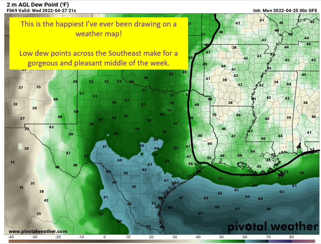
Tuesday Afternoon – Friday: Enjoy The Low Humidity!

Upper level ridging takes over after the front really pushes through the region on Tuesday, leaving sunny skies to bask in for the rest of the workweek. Along with it, the airmass behind the front is cooler and much drier. Low humidity will be the story for much of the Southeastern US, with only eastern Florida and Houston/Dallas/Austin getting in on somewhat higher humidity values. Highs in the 80s and lows in the 50s is on the menu for the Gulf Coast and potentially from 40s up toward the I20 corridor.
By Friday, things will start to change as the upper level ridge will start to erode some and over toward Texas and southwest Louisiana moisture transport toward the Plains will bring back the humidity to sweaty levels.

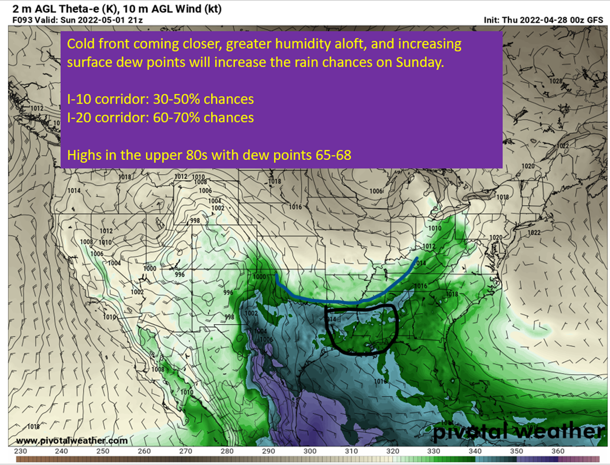
Humidity Returns For The Weekend
There’s going to be a storm system move through the Great Plains on Friday into Saturday, which is going to turn the wind to be out of the south. This will all lead to a breezy weekend through the Southeast, with humidity surging back into the picture by Saturday. Rain becomes a question on Saturday and Sunday, but I think there will be enough of a ridge overhead Saturday to keep the rain away. Cloud cover should be increasing though.

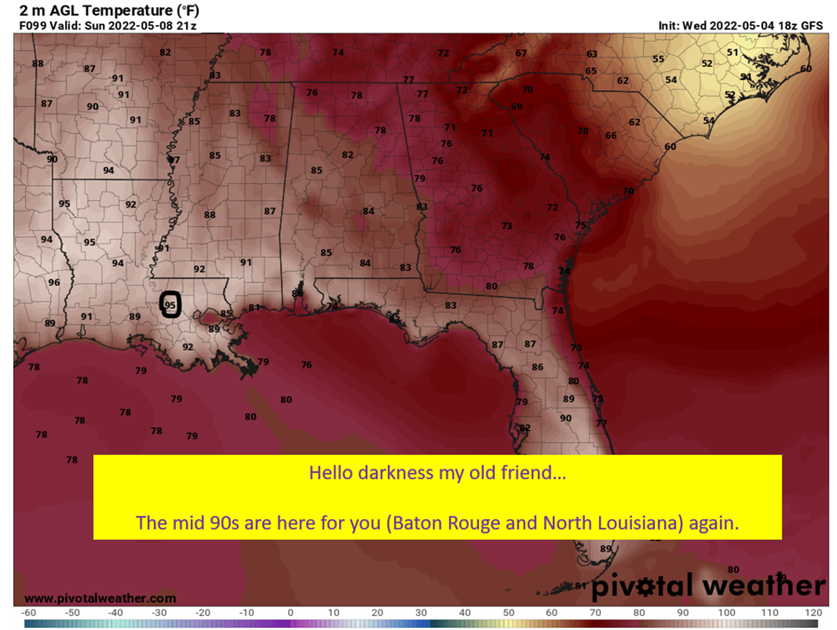
Sunday: Rain Chances Start Returning
Models and ensembles are diverging on solutions by Sunday. The European model brings a subtle shortwave through Texas and Louisiana on Sunday and would bring scattered rain chances to the Gulf Coast and up into interior Louisiana and Mississippi. The GFS doesn’t have this and instead sticks with the weak ridging. This would likely mean nothing but isolated rain chances for the Gulf Coast and would probably be dry into the interior of Louisiana, Mississippi, and Alabama. The image above shows the GFS version of events, with just a flattening ridge. Below, I’m going to show you the European solution and circle the disturbance.
Right now, I’d do like the NWS did this morning and split the difference on Sunday. Put rain chances at 20-30% but remember this is likely to either end up 0-10% or 40-60%. I’ll have a weekend forecast on Friday once this has been sorted out.

tl;dr version
The workweek starts off humid and with rain chances. The most rain will fall for central Louisiana and Mississippi today as the front slows down. It will eventually push through to the coast overnight tonight, bringing some rain chances with it. A couple of storms could reach severe limits with the dry air aloft leading to strong winds as updrafts collapse and fall on themselves. There’s no shear to organize storms today, so this threat will be very much isolated.
By Tuesday afternoon, the humidity should drop for most of the Southeast and stay that way through at least Friday. It will start picking up for Texas and Southwest Louisiana interests by Friday in response to a storm coming through the Plains. It will start increasing for the rest of the Southeast at this point too, but will still be nice by late April standards.
This weekend the humidity finally returns and the wind picks up out of the south. Saturday should be dry with some increasing cloud cover. By Sunday there are significant differences in modeling that could either lead to another dry day or bring scattered showers. It will still be warm and humid, no matter what ends up playing out.
That’s it for today. Got a few posts on tap for this week. I’ll be looking back on 4/27/11 on Wednesday. Talking about Ryan Hall Y’all and what his streaming success might mean for the weather enterprise and storm chasing. Plus, drought in the south and a weekend weather forecast come Friday.