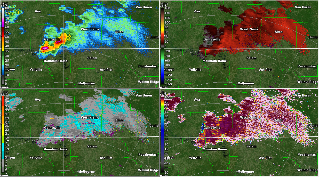
On April 15th 2022, a tornado emergency was issued for a supercell in northern Arkansas. This is the most serious of tornado warnings, reserved for damaging tornadoes. The problem? There wasn’t actually a tornado. In this post I’m going over what happened. I’m going to look back at the radar and discuss how the distance […]
Category: Severe Weather
Posts about severe weather events
Severe Threat Shifts East on Wednesday
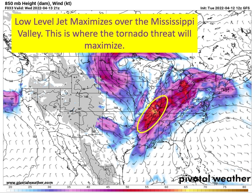
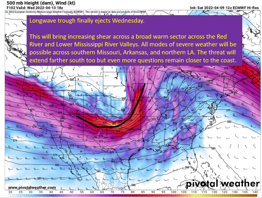
The active pattern is set to end Wednesday, as a widespread severe risk moves into the Ohio and Mississippi Valleys. Unlike the last couple of days, there won’t be a cap in the way and storms should have no issue firing within a broad warm sector. Of course, with no cap comes questions of convective […]
Tuesday Severe: Boom or Bust
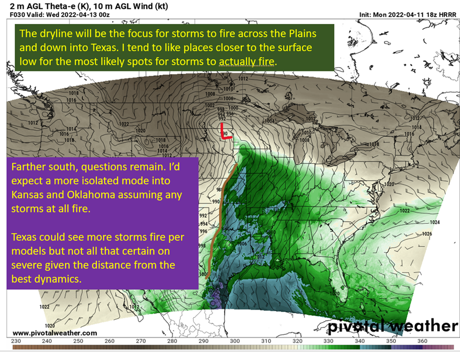
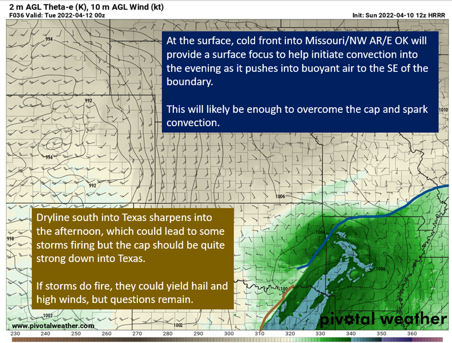
Rick Smith, Warning Coordination Meteorologist at NWS Norman, put it best on twitter this afternoon. “Conditional: subject to, implying, or dependent upon a condition. Tuesday’s severe weather potential is HIGHLY conditional, and the condition is that we see storms form at all.” Give @ounwcm a follow, he’s a great meteorologist. This really gets to the […]
Monday Severe and Previewing Tuesday
April is living up to its reputation with another multi-day severe weather threat. Tomorrow, we have a slight risk (2/5) running along I30 and up toward Memphis. It is not as apparent as the Tuesday and Wednesday threat, but certainly some hail potential in Dallas (shocking I know…) and a tornado threat into Arkansas. I’m […]
Models (Finally) Converge On Solution. Doesn’t make the forecast any easier.
After a long week of significant differences between the European and GFS, we finally have some agreement this afternoon on timing for the upcoming severe weather. It looks like Wednesday will see the longwave trough eject east and bring the threat of severe weather into the Gumbo Weather region (LA, MS, AL, AR). There are […]
About Next Week
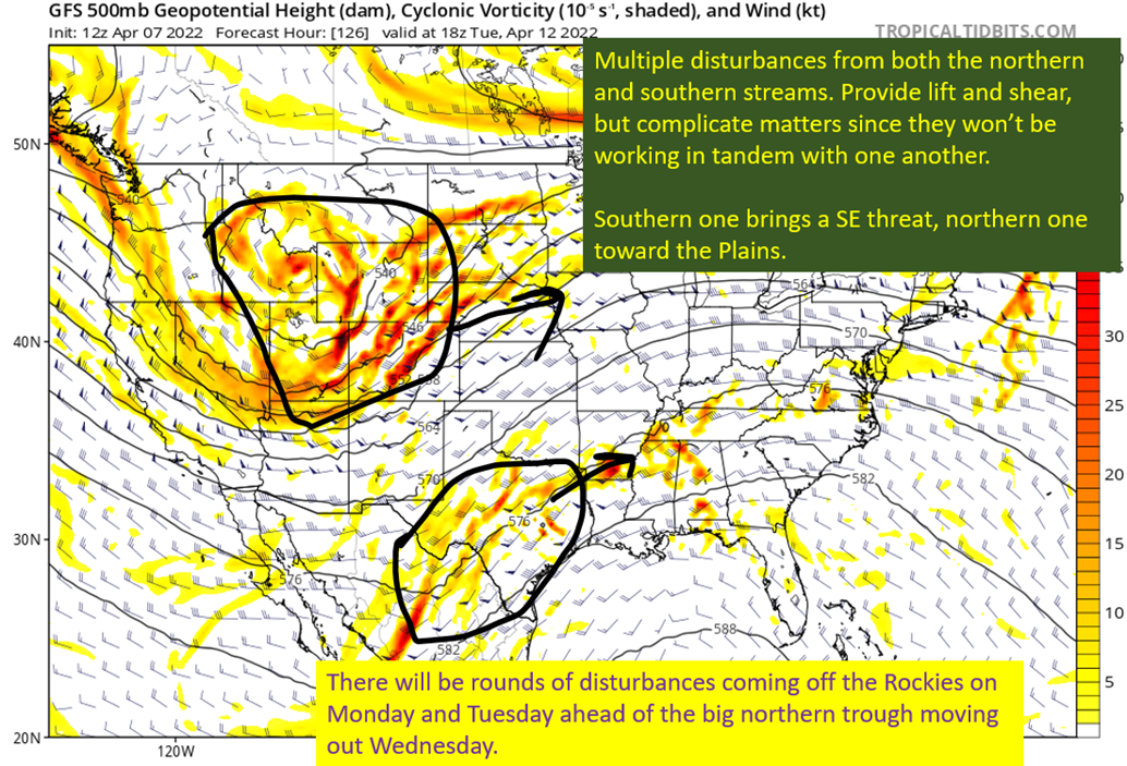
The Gulf Coast got away with minimal impacts this week, but there’s another severe set up to come next week. Right now, we have the plains looking to have a couple of days of risk Tuesday and Wednesday. Thursday will probably have things shift into the Southeast, but there’s still substantial model spread as to […]
Wednesday Severe Threat Moves To AL/GA For Second Straight Day
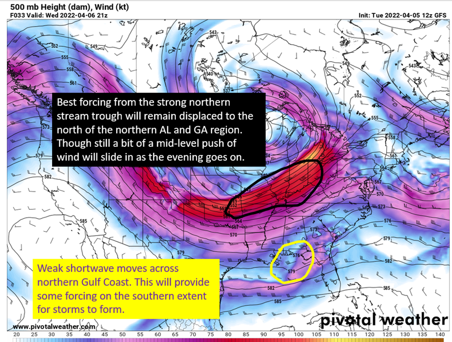
After a round of potential severe storms today across southern Alabama, Georgia, and even SC there will be yet another risk for severe weather across Alabama, Georgia, and into southern Appalachia. There is significant uncertainty in terms of how well the atmosphere will recover in the southern parts of Alabama and Georgia following the severe […]
Severe To Start The Week
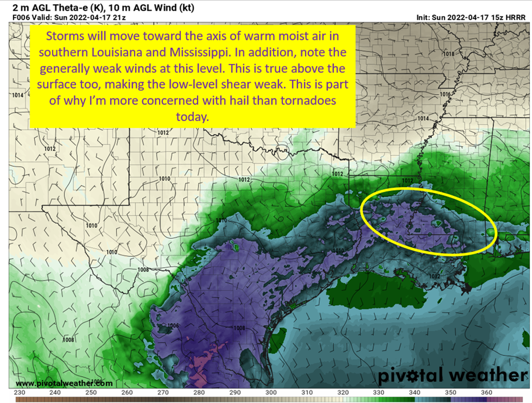
Potential for severe weather will develop into the evening and overnight with high winds and hail being the primary threat though a tornado or two cannot be ruled out. Storms will start firing over central Texas by the afternoon on Monday and begin to cluster into a more organized line as they approach DFW. This […]
Monday and Tuesday: Digging Into Severe Potential
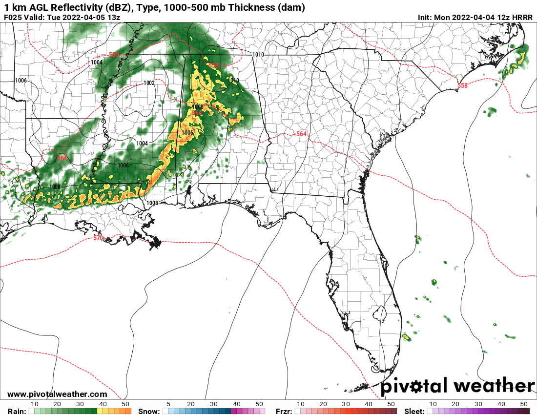
Differences remain in the modeling, with European and Canadian bringing storms farther south into Louisiana before moving into MS/AL. GFS remains quicker moving things, and keeps south Louisiana mostly dry before sparking storms in MS, AL, GA, and TN. Monday during the day is starting to look wet, but not likely to be producing significant […]

