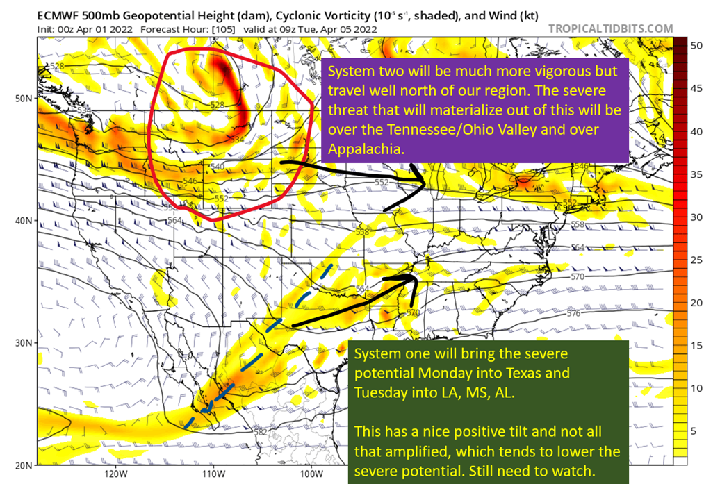
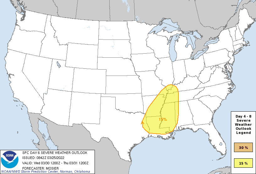
Once again the SPC has a severe risk for next week across the entire southeast over a three day period. This system does not look as potent to me as the last two, but still enough there to warrant some discussion. Going into the following week, potential is building for yet another significant severe weather […]
Category: Severe Weather
Posts about severe weather events
What’s Ahead For Gumbo Weather
Beautiful weather on tap across the northern Gulf Coast through the weekend, except some rain potential on Saturday. Nice time to take a step back, breathe, and tell y’all a little of what I have planned over the next couple of months. First of all, I want to thank all of you who have come […]
Nowcasting The Severe: Wednesday 3/30
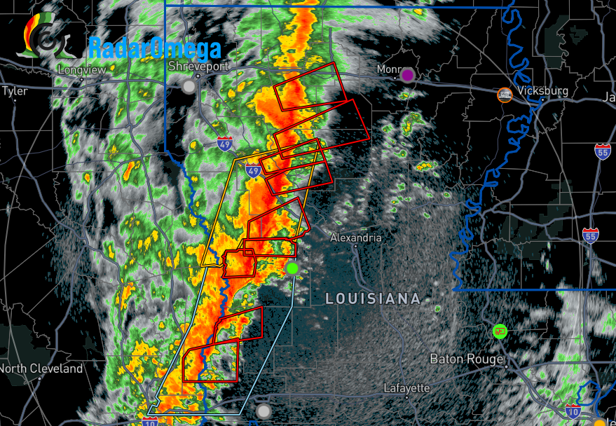
Tornado warnings are starting to pop within the line in Northern Louisiana. Time to take a look at see how it is actually evolving. First of all, at the surface: Image from SPC Mesoanalysis Page. Pressure falls ongoing across northern LA as the surface responds to the upper level forcing from the splitting jet stream […]
Damaging Winds and Tornado Threat Wednesday
The entire state of Mississippi is under a moderate risk (4/5) tomorrow for the potential for damaging winds. Overall this is the most expansive moderate risk zone I think I’ve ever seen. The risk extends into southern Louisiana and all of western Alabama as well. Plus Memphis has been included. The main concern is the […]
Wednesday Severe Threat Coming Into Focus
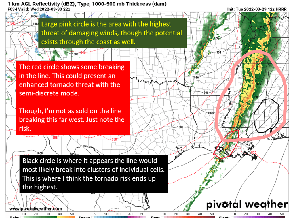
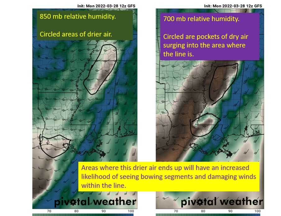
Strong line of storms are expected to move through Louisiana and Mississippi through the late morning and afternoon on Wednesday. The most widespread threat will be damaging winds with strong winds aloft being pulled to the surface in downdrafts, especially where the best surges of dry air aloft will be. I’ll be watching any bowing […]
End of March Severe Threat: 3/30 Deep South
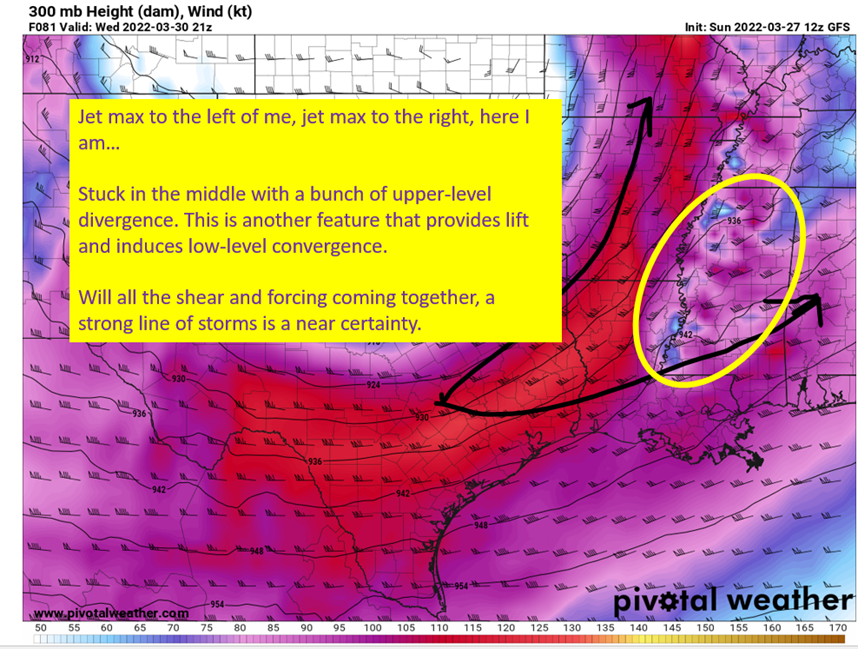
Another week, another severe weather threat incoming. The Storm Prediction Center already has a 30% up across the I20 corridor with Northeast Louisiana, most of Mississippi, and western Alabama in this highest risk window. Further south, we have a 15% risk for the rest of Louisiana and along the Gulf Coast. The main concern is […]
Here We Go Again: Severe Weather Middle of Next Week
Through the weekend and into Monday an upper level trough is expected to migrate east out of California and into the Plains. By Wednesday it will swing NE through the Plains and Mississippi Valley while taking on a negative tilt. A strong surface low is expected to form ahead of it and draw warm moist […]
The Arabi Tornado Last Night: Quick Case Study
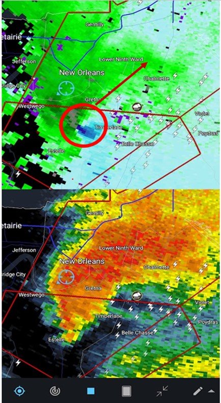
Spent most of the afternoon expecting to post about how the forecast bust yet again for Louisiana and this time southern Mississippi, but that changed about the time I took my family downstairs as an apparent tornado crossed the Mississippi just to our east. Storm survey was done this morning at rated the tornado in […]
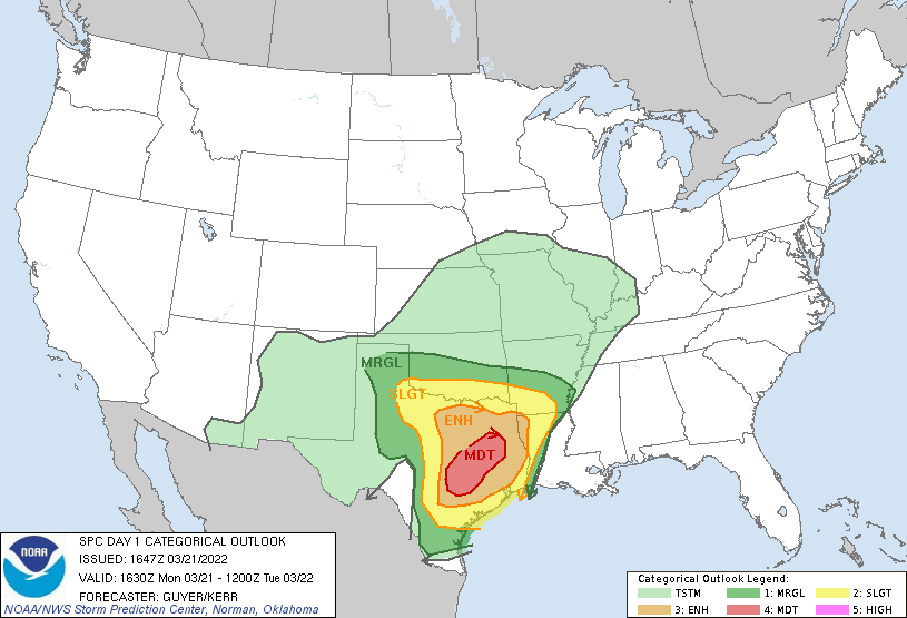
Potential Severe Weather Outbreak: Tuesday March 22nd, 2022
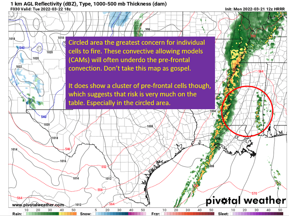
All the ingredients for severe storms and tornadoes will be in place tomorrow afternoon and tomorrow evening across Louisiana, Mississippi, and western Alabama. This is the time to have a plan ready if a tornado or severe thunderstorm warning is issued in your area and to make sure you have multiple ways to get warnings […]
Severe Outbreak Potential: Texas And Western Louisiana Today
A significant severe weather outbreak is expected tomorrow over Louisiana and Mississippi. Today, I want to look at how the system is currently evolving over Texas and then I’ll have another post concerning the Louisiana and Mississippi severe potential later on this evening. So first off, looking at the surface observations in Texas. We have […]

