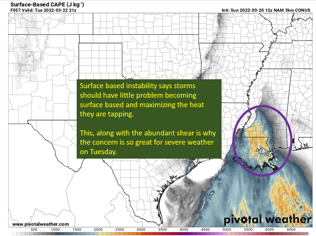
Significant severe weather threat will materialize early in the week, with Tuesday presenting the potential for an outbreak across SE Louisiana and southern Mississippi.
Category: Severe Weather
Posts about severe weather events
So The Forecast Busted In Louisiana
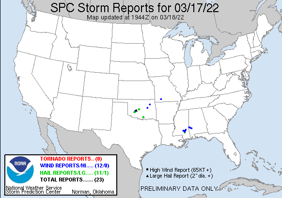
You spend two days warning about hail, wind, and in detail about how there’s a tornado threat and then… Nothing. Not a single severe weather report in Louisiana last night. This is unquestionably a good thing, I’d prefer the weather not cause people harm or worse. All that said, I hate to raise people’s anxiety […]
Tornado Risk For The Northern Gulf Coast
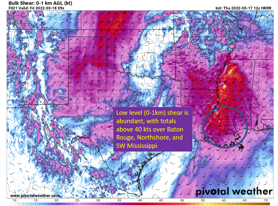
A tornado risk will increase overnight as storms move into Louisiana, Mississippi, and Alabama. The culprit will be increasing low level instability, though it isn’t all that impressive, but the low level shear could be enough to overcome and help mature updrafts in the low levels. As mentioned yesterday, the more widespread risk is for […]
Severe Weather (Again): Thursday Night
East Texas through southeastern Louisiana at risk Thursday night into Friday. Mississippi coast through the Panhandle gets into the action on Friday. Severe season continues with Thursday night and Friday morning looking a lot more interesting. I currently think the main risk is going to be gusty winds in thunderstorms. Large hail is also a […]
Tuesday Storms Yield To A Pleasant End Of The Week
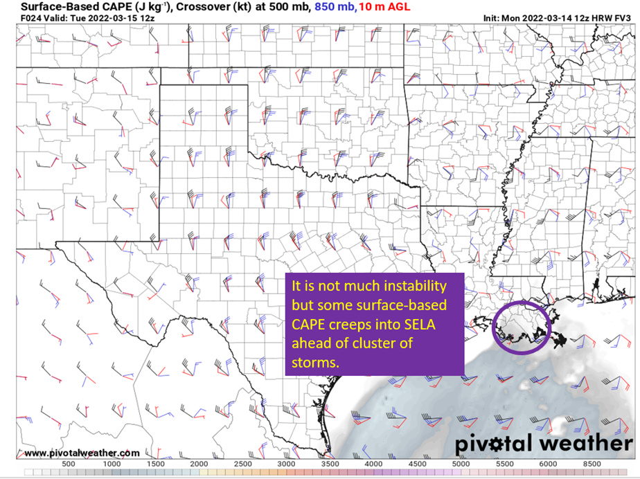
Upper low will slowly translate east across the northern Gulf Coast on Tuesday, presenting the potential for severe weather through the day on Tuesday. The main threat appears to be hail, with very cold mid-level temperatures moving into the area with the upper low. There is not much instability available, but the far southeaster parishes […]
Severe Weather: New Orleans Thru The Panhandle (3/11/22)
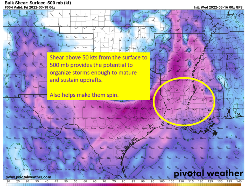
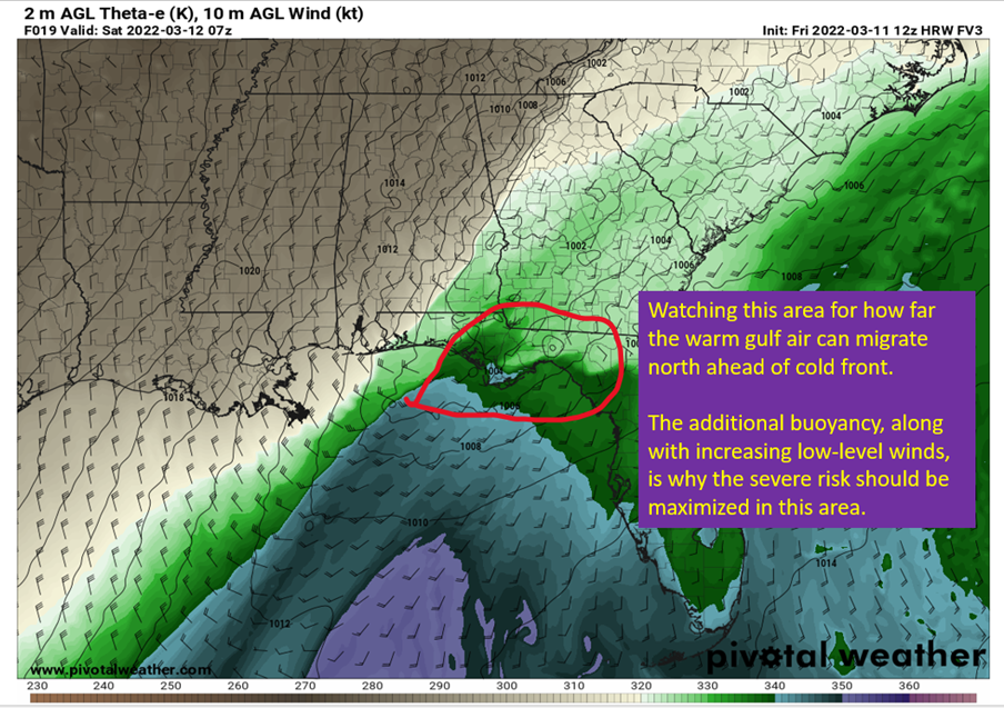
A vigorous longwave through moving east across the plains today will serve to provide a severe threat across the northern Gulf Coast. Questions on instability remain, but there will be abundant shear available to organize storms and it will be increasing through the night. This means the severe threat will increase as you go east. […]
Severe Threat: Mobile and Coastal Mississippi Tonight (3/8)
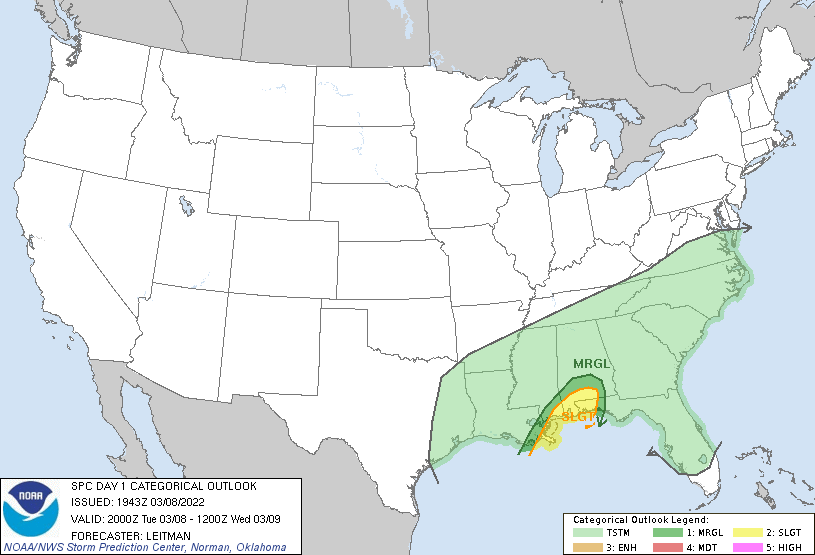
Slight Risk (2/5) of severe storms along the central Gulf Coast tonight as warm front advances over the region ahead of disturbance. Near the warm front will have the strongest shear and warm moist air to give a little instability, so if there are to be severe storms I’d expect them near there. Image From […]
March 6th Severe Threat: Arkansas and Southern Missouri
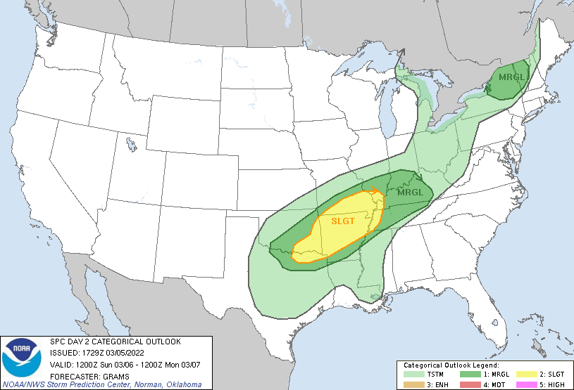
Tomorrow evening, a slight (2 out of 5 from the Storm Prediction Center) risk exists for severe weather from eastern Oklahoma into all of Arkansas and southern Missouri. I’m going to be watching the “warm” sector, where dew points will be in the mid 60s and temperatures in the 70s. This will be the area […]
Endymion and MOT (Saturday) Forecast
Very uncertain on just how warm it will get on Saturday, as questions persist on how much cold air actually gets driven into the area. It will not be humid though, and temperatures should be very comfortable. Temperatures will drop into the 50s overnight, but it does not look to be colder than that at […]
Friday Parade Forecast: 2/25
Cold front passage on Friday morning with a light band of rain yields to a night of parades in the low 60s, but questions remain on just how far SE the front gets. Will be a cloudy day, but even if the cold air behind the front doesn’t push through until Saturday morning…the brutal humidity […]

