The GumboWx 2023 Hurricane Season Preview. El Nino vs A Lit Atlantic. Spoilers: El Nino eventually wins but not before a possibly above average hurricane season.
Category: Tropical

Posts about tropical weather
The Media Coverage Of Ian Has Been Frustrating
A tough approach angle made uncertainty all the more challenging in messaging. Today, I’m working through some of my own thoughts on storm communications.
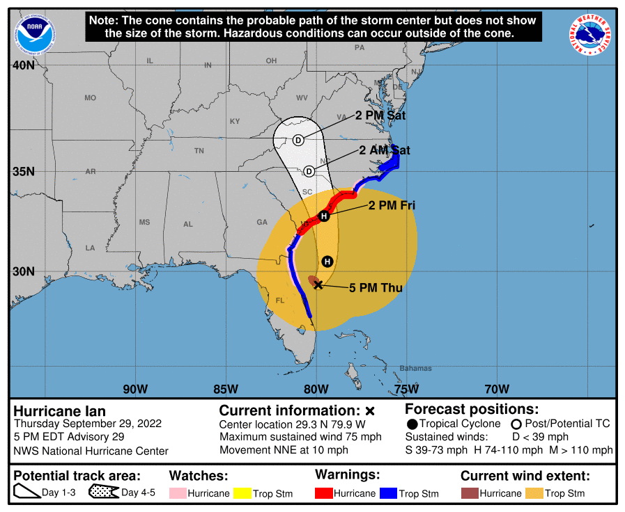
Hurricane Ian To Make Second Landfall In Carolinas
Hurricane Ian continues its relentless journey across the SE United States. After devastating the SW coast of Florida yesterday, Ian takes aim at the Carolinas will strong winds and life threatening surge expected.
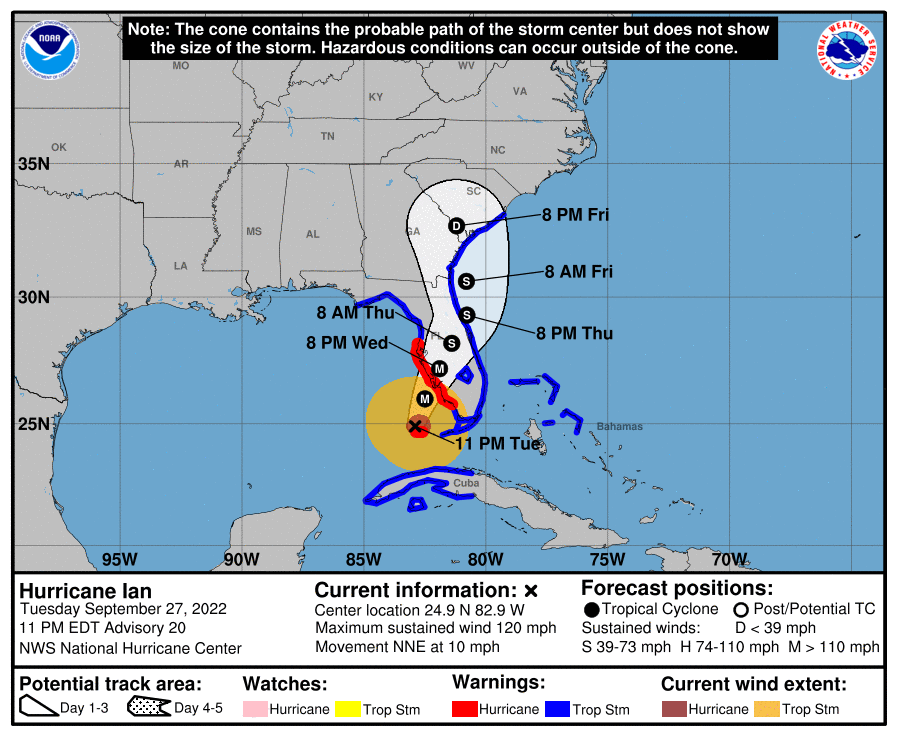
Hurricane Ian Strengthens and Grows Larger With Landfall Tomorrow
Hurricane Ian is making it’s final approach to the SW Florida Coast. It is expected to be a Category 3 or 4 at landfall. It will bring a tremendous storm surge and inland flooding.
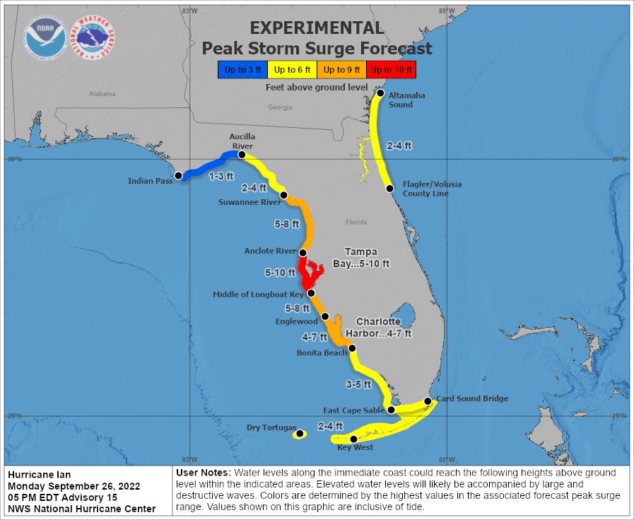
NHC Forecasting Near Nightmare Scenario For Tampa
Hurricane Ian is strengthening this evening after a day of the models converging on Tampa. Those in the Tampa region need to take this extremely seriously and pay attention to your local NWS office along with the NHC for the best information for your area.
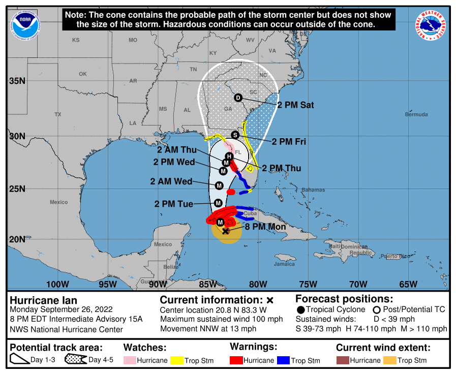
Tropical Storm Ian’s Strengthening Phase Is Starting
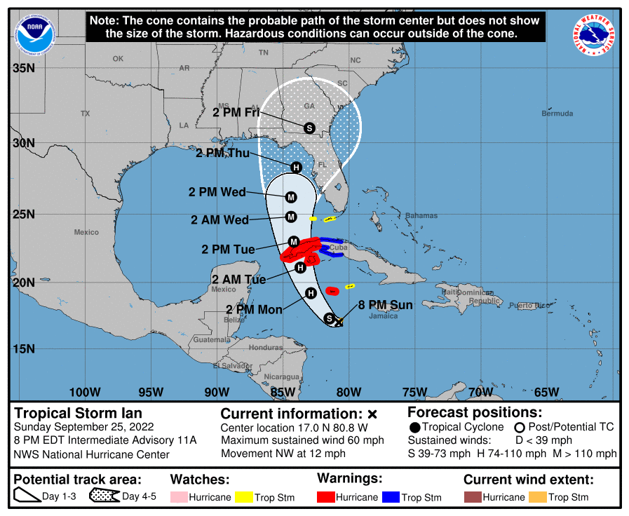
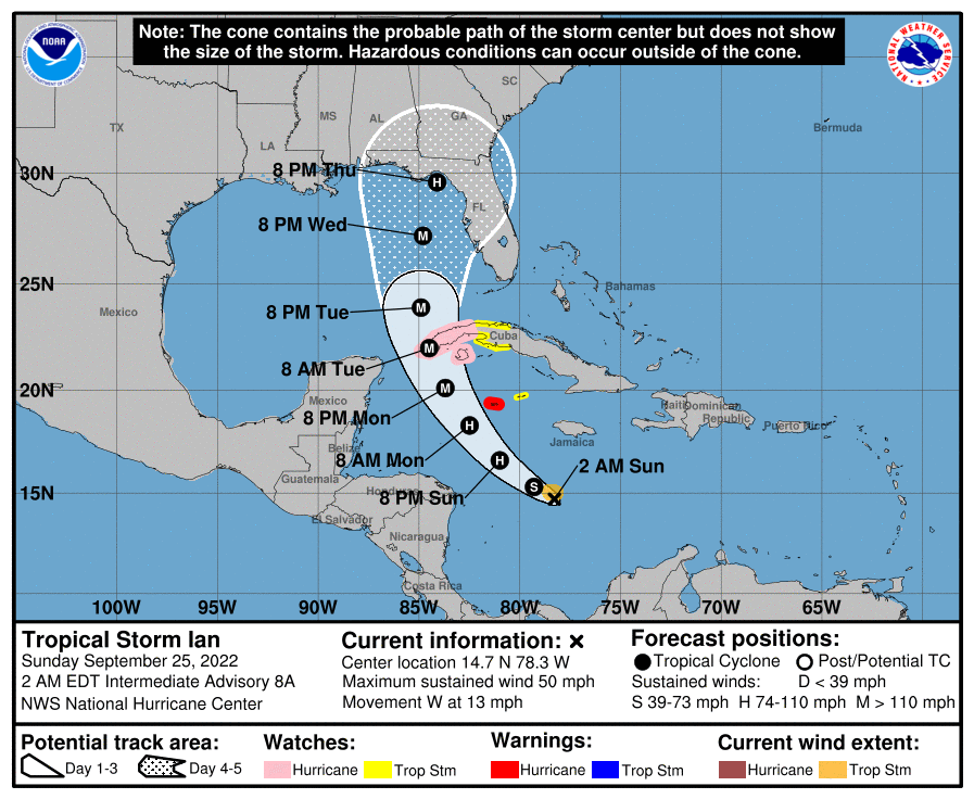
Tropical Storm Ian is beginning it’s rapid intensification phase this evening as the models start to converge toward the Big Bend or West Coast of Florida.
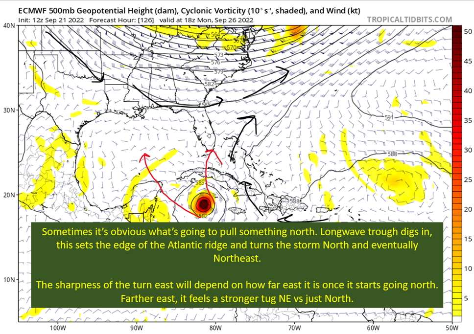
Tropical Storm Ian Churns in Caribbean As Models Shift West
Tropical Storm Ian enters the window to organize and strengthen quickly over the next few days. All the while models continue to disagree on track.
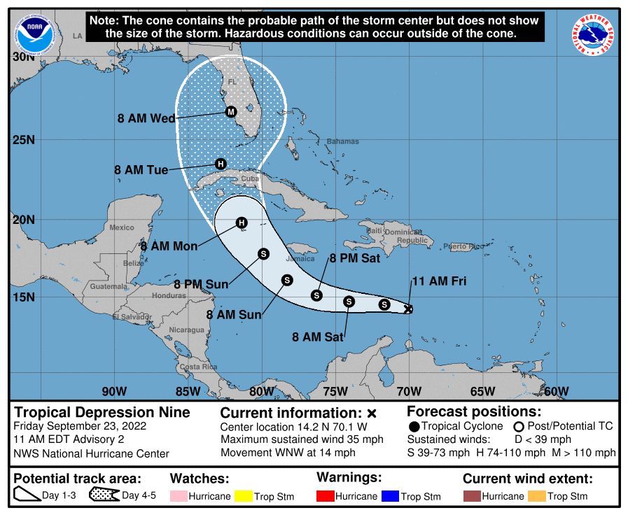
It’s Officially TD9, And The Models Are Targeting Florida
TD 9 has officially formed in the Eastern Caribbean. The West Coast of Florida is under the crosshairs as things stand today. This will also probably be a significant strike to the region.
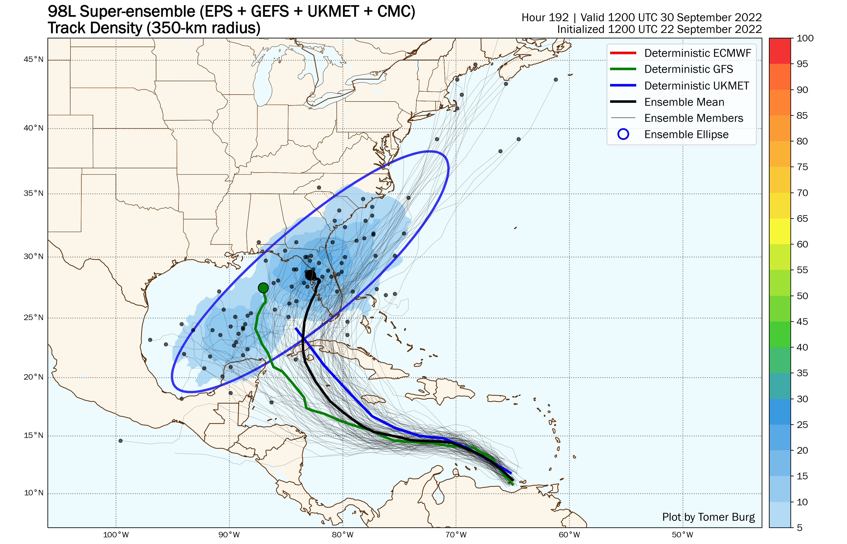
98-L: The Model Madness Continues
98L continues to fight shear and work toward closing off into a tropical low. It also continues to befuddle the models. Trying to bring some clarity to the clear as mud modeling picture.
Getting To Know The Steering Players For Future Hermine
Today I dive into what this early shear, an upper low in the NW Caribbean, and the giant longwave trough over the eastern United States will mean for the future path of future Hermine.


