Expecting Danielle By The Weekend. Otherwise, Shear and Dry Air Dominate.
For all the discussion I did of the MJO and CCKWs, it just doesn’t matter when the subtropics keep printing upper lows. The tropics woke up in the last week of August, as I expected, but they woke up to the subtropics beating them with a sock filled with nickels.
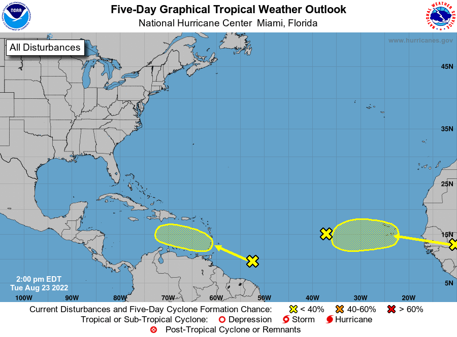
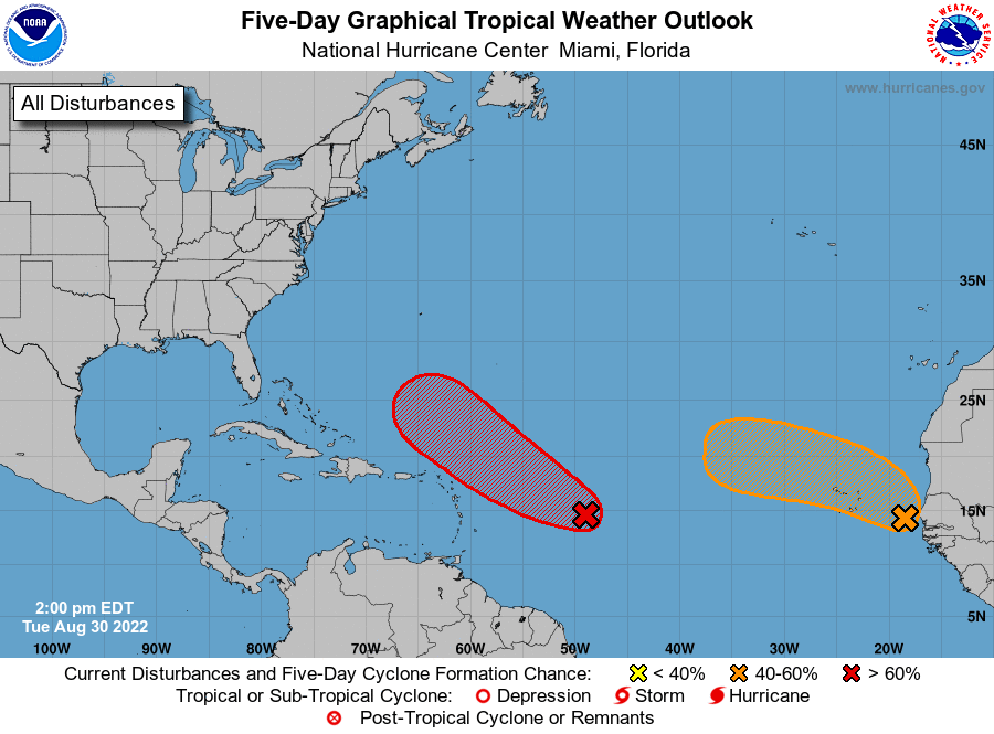
There is a lead wave, the one highlighted in red by the NHC above, that I also believe will finally get the fourth name of the season. It is destined to miss land, but has potential to be a long lived storm across the Atlantic. Otherwise, things actually look quiet into the first two weeks of September. If future Danielle doesn’t manage to be long lived, we will be in near record territory in terms of how slow this season has been.
No complains here, but we’re getting into historic territory nonetheless.
Today, I’m going to show you the hostile subtropics. Talk about the prospects of 91L (future Danielle, well maybe) and marvel at how slow this August has been in the Atlantic.
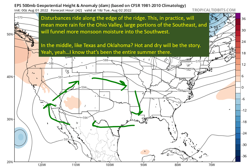
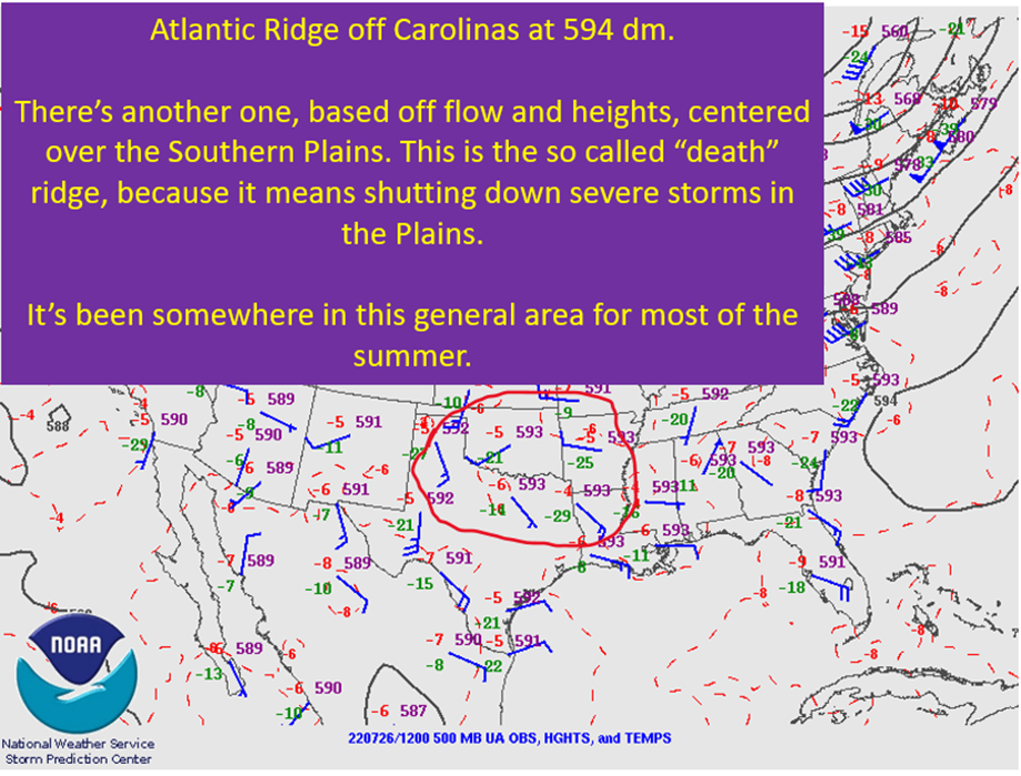
Flow Remains Amplified In Subtropics. Upper Lows Yield Shear and Push Dry Air Into Tropical Development Region.

The reason the tropics have been so quiet is pretty simple. Tropical systems hate dry air and shear. There has been a bunch of dry air and shear where tropical systems try and develop. It is not simply not letting waves organize, but actively degrading them as they cross the Main Development Region. This is leaving nothing to develop once something gets to the more conducive parts of the Western Atlantic.
This should continue to be the story into the first week of September, at least, as this amplified pattern should continue in the mid-latitudes. After that, questions arise again as a Super Typhoon in the Western Pacific should turn northeast into the mid-latitude flow. These interactions can have large effects on the synoptic pattern down the road, so I’m not going to speculate past September 7th or so.
In other words, I don’t foresee a Gulf of Mexico threat through September 7th. I really only expect one storm in the period, and it will stay away from land.
91L’s (Future Danielle, maybe) Future Remains Uncertain

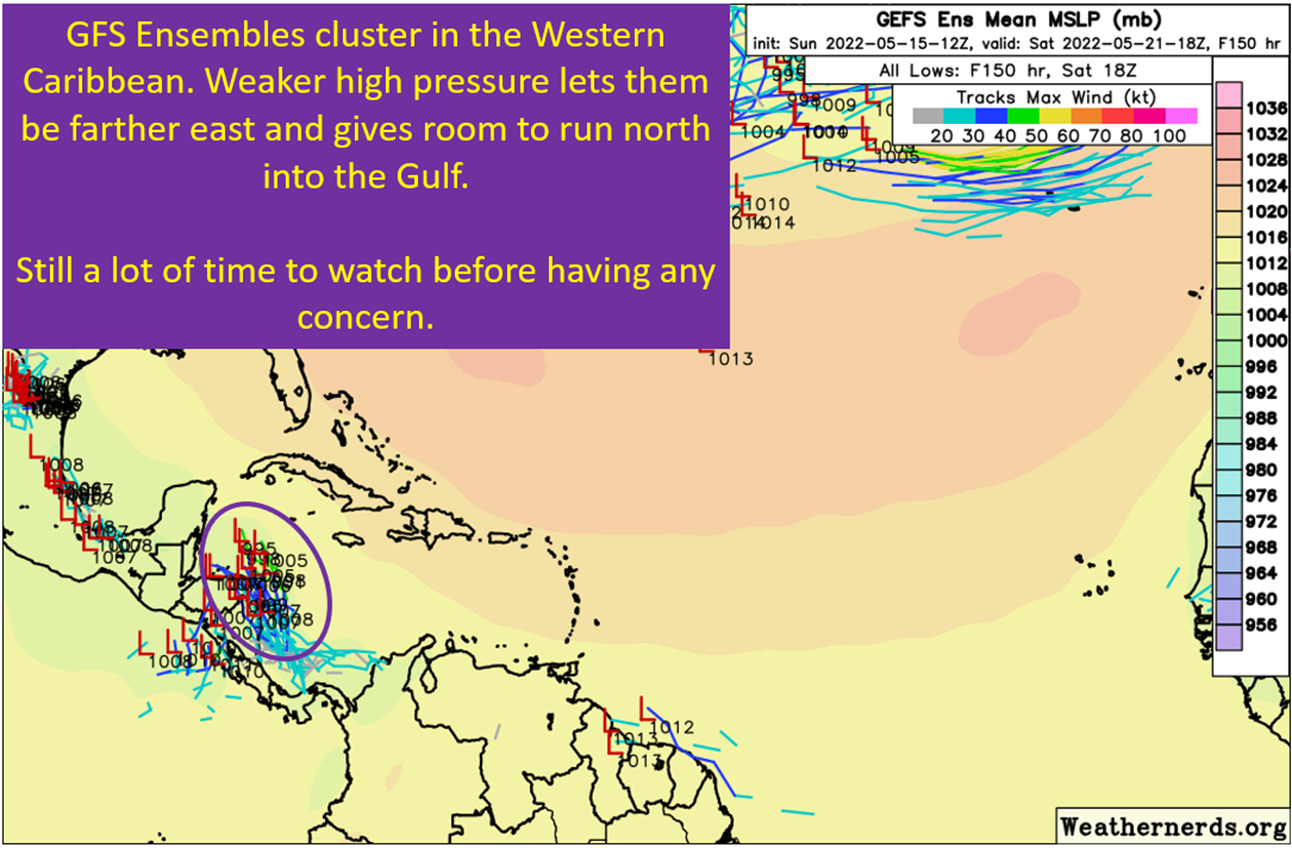
It’s support, but do note it takes four to five days before any strengthening starts to show up. The reason is, as you might have guessed from the previous section, 91L is currently getting hammered with shear and has dry air lurking nearby. I’m more inclined to believe this wave has a chance, even after this beating, because it has survived this long. A more mature wave has a better chance of surviving this gauntlet.
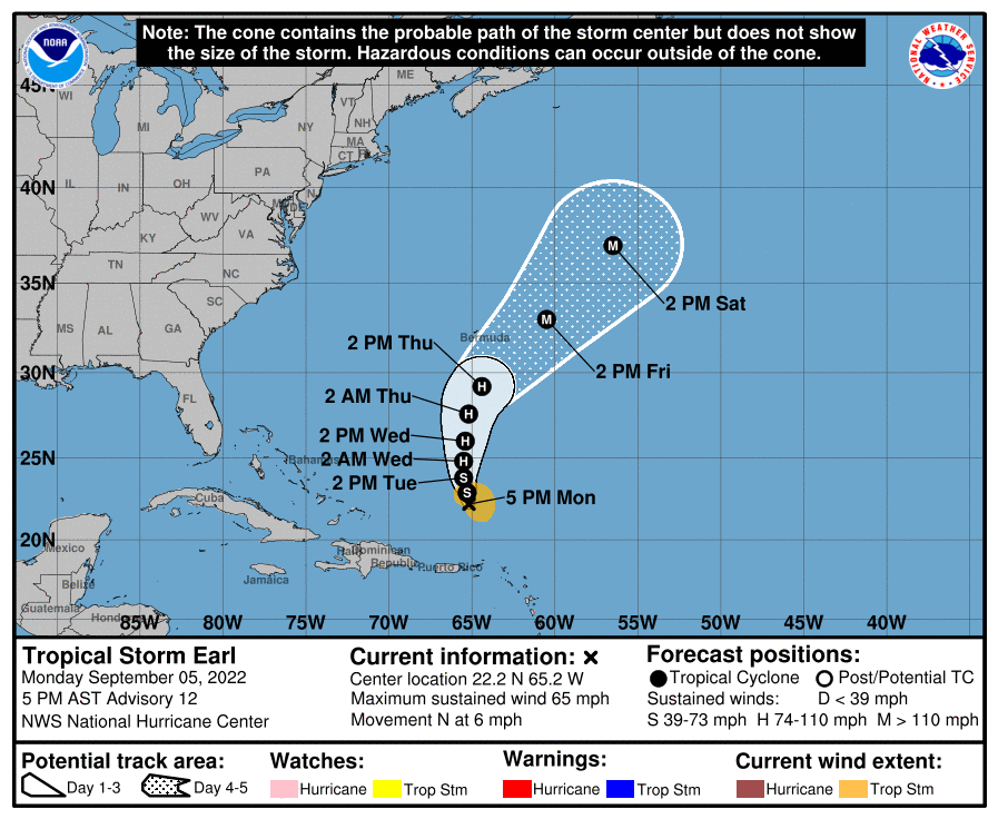
I also need to point out the direction the storm would end up taking. Curving nicely into the open Atlantic and not threatening land.

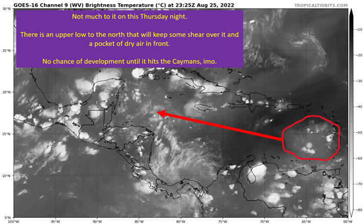
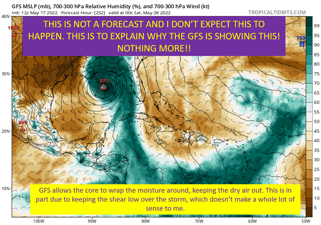
High clouds are blowing from N to S. I see lower based thunderstorms going up and moving from SW to NE. Looks like a ton of shear to me and looking at the model depictions, they agree too. This must abate if this wave is going to develop. Models are split on how it develops from here. The GFS allows it to fight off the nearby upper low and create a pocket of benign shear due to putting out enough outflow from the convection. The European model doesn’t allow it to fight off the shear and keeps the system weak.
I’m inclined to go with the GFS, as we’ve seen some similar situations between the two models over the last couple of years. The Euro ends up too weak, the GFS too strong but closer to the reality. At least, that’s my experience and especially in the part of the basin north of the islands.
August 2022: Zero Named Storms In The Atlantic
It’s a La Nina, again. It appears to once again be strengthening. We have the MJO in a very favorable phase, and it’s been there for the last ten days. I wouldn’t have believed you if you told me we’d have all that in the last ten days of August and see ZERO named systems. I’ve already discussed the why, concerning the beatings subtropical upper lows are giving these tropical waves.
Even knowing why, it is amazing. This time last year, SE Louisiana was recovering from Ida. Two years ago? Laura had just devastated Lake Charles and SWLA. This year, we’re still waiting on the “D” named storm. It is great news for the Gulf Coast, who need this season to remain quiet. I must note, I’ll never write off September for producing hurricanes. I’m just happy we got through this particular part of the calendar without seeing a storm.
tl;dr version
This very quiet hurricane seasons continues that direction, with only one wave with realistic potential for development. This is as we head into Labor Day weekend. The reasons for this lie in the subtropical regions of the Atlantic, as shear and dry air transport look to continue over the open Atlantic into the first week of September. There is one wave, 91L, that has a good chance of development by Friday or Saturday. This system would be named Danielle, and looks destined to spend its life in the open ocean.
This means the Gulf Coast doesn’t have a foreseeable tropical threat through the first week of September. So go enjoy the weekend, assuming it ever stops raining. Geaux Tigers. Mickey Loomis is just the worst for trading CJGJ for a 5th and two 6ths. What a clown.

