Summer Is Taking Over Early, My Apologies
The Rundown
Did you enjoy all the 90 degree weather this past week? Well, good news, we’ve got another heaping helping on tap next week. The upper low bringing the rain chances for Friday and Saturday will be swept to the NE and more ridging will build in behind it. That will support yet another round of high pressure at the surface, few clouds, and hot temperatures. 90s will overspread almost all of the Southeast next week and portions of Texas should easily get into the triple digits.
Join me, as I explain why next week is going to be so summerlike.

Ridging For The South, Mostly
The overall look across the country is going to be the southern half is hot and the northern half is cool. In our neck of the woods, a little bit of ridging builds in for most of the week with a few shortwaves cutting across the northern periphery. In general though, this is a look that supports sinking air and high pressure at the surface. This means the upper levels are going to support hot weather at the surface. Yes yes, don’t everyone celebrate at once.

Atlantic High Pressure Keeps Us Toasty
The Bermuda High shifts south this week, enhancing the gyre potential discussed yesterday and putting additional influence over the Southeast. The result is another round of 90+ degree weather and enough humidity to make the experience unpleasant. Some signs are there this might start to change by next weekend, but it is unlikely there will be much relief from the heat as we plow into the later parts of May.

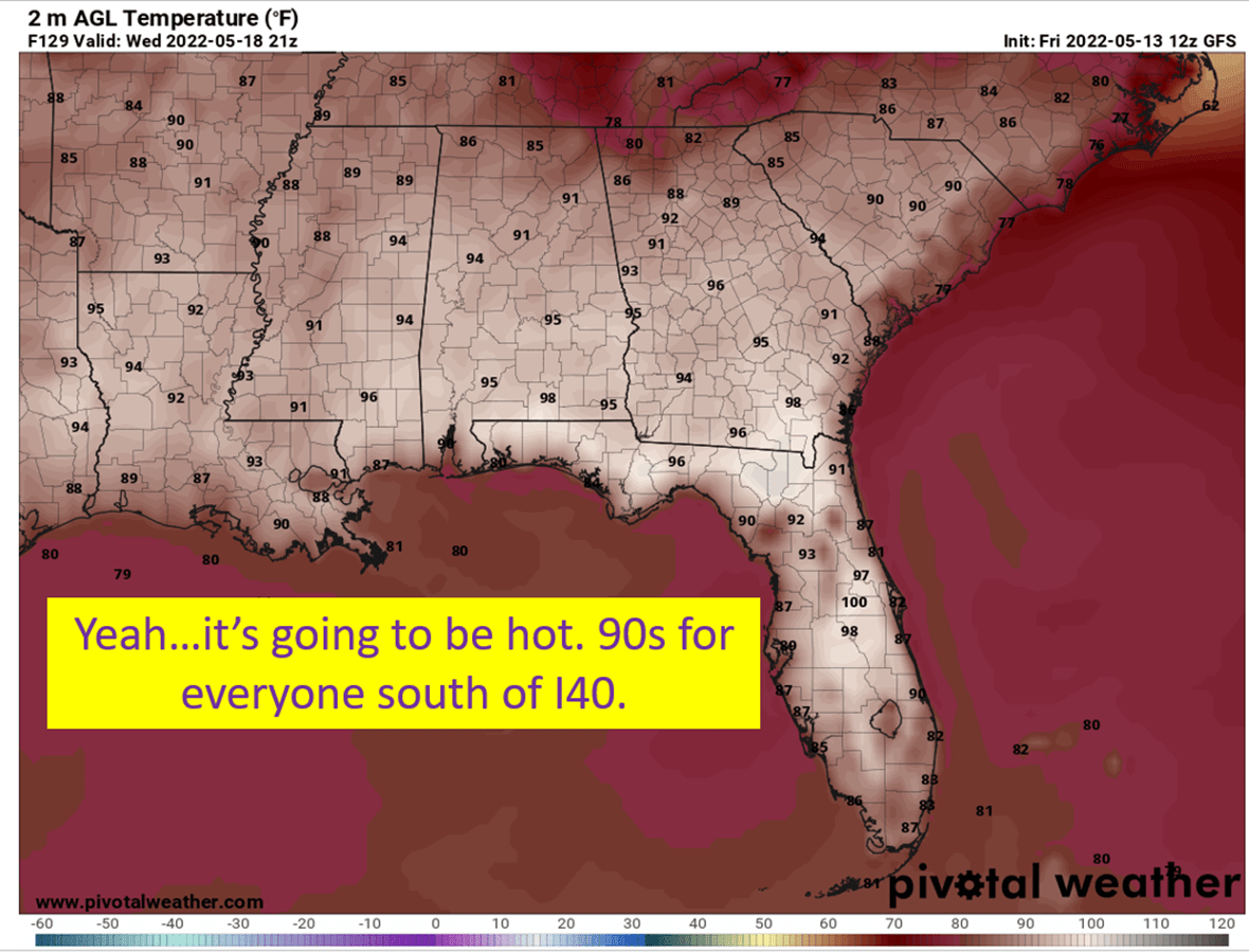
Summer Temperatures Take Over
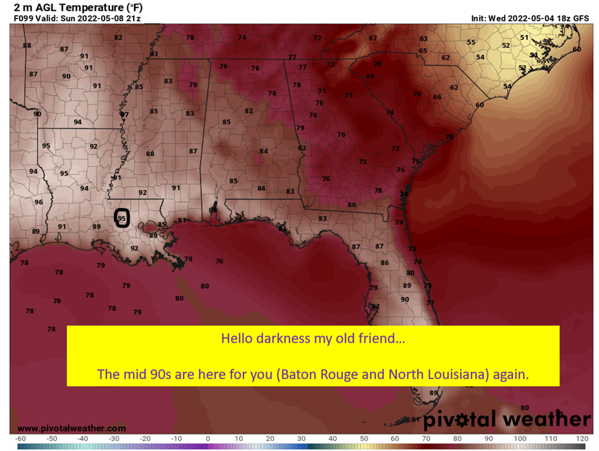
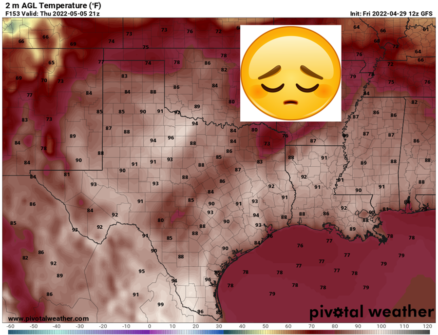
This pattern brings 90s all over the Southeast, unlike last week where Georgia avoided the pain. Some locations in central Florida may even approach 100. It won’t just be the Southeast either, with most of Texas sweltering next week. Dallas, based on the NWS model blend, won’t dip below 98 for a high until Sunday of next week. Mobile will hang near 90 for the next week, with the marine influence helping to keep temperatures a little more reasonable. I’ll post a table with temperatures tomorrow for locations, so you can see how your particular neck of the woods shakes out.

Humidity Will Wax and Wane But It’s Overall Not That Bad
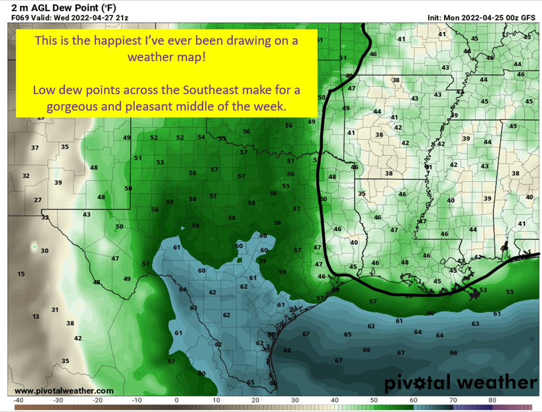
In Louisiana, Mississippi, and Arkansas the humidity is going to be more intense. The Euro is consistent with dew points near 70 across the region. The GFS waxes and wanes with the dew points over this region, with some days only in the mid 60s. I’d tend to think with the southerly flow that the dews will be more like the European solution for the western portions of SEC country. To the east, it just isn’t that bad. I see a bunch of lower 60s, even on the European. Some days the GFS wants to put large portions of Alabama and Georgia into the 50s on dew points. Which is comfortable for this time of year.

tl;dr version
Mother Nature ain’t easing us into to summer this year. It arrived the second week of May and will continue to cook on next week. Some maybe slightly cooler weather the following week, but way too far out to have any certainty on. Focusing on next week though, there will be little in the way of relief. Low to mid 90s will dominate the Southeast. Some triple digits over in Texas. Humidity will be a pain for Louisiana, Mississippi, Arkansas, and areas near the Gulf of Mexico.
I guess it’s good news for me that I’m running to the mountains for the summer. The bad news is, summer made sure I remembered her before I leave.