Third Week In May: The Big Weather Stories
This isn’t going to be a long post, at least in terms of explanation. I want to give you an idea of what to expect in terms of temperatures next week. Going to give you the outputs from the European and GFS, along with the model blend the NWS uses. Plus, I’m going to give you the ensemble mean. In part this is to show you what you can actually expect and the ranges. In addition, to illustrate how different models can be even with the same idea.
Then I’ll talk a bit about the tropical system that might form down near Central America at the end of the week.
Finally, do an overview of the severe potential around the country next week.
Summer Temperatures Come For The Southeast
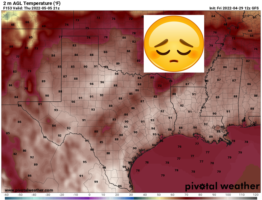
ERCOT over in Texas has already put out a warning to conserve power due to the unusual May heat expected next week. Across the Southeast, temperatures will be into the 90s by the middle of the week. Some relief comes for Arkansas and northern Texas by Saturday, but the heat is certainly on. Below I’ve put together a table for a handful of cities around the Southeast, showing the projected high temperatures from a few models. The first is from the NWS Model Blend (MB), typically will be the closest to accurate. The second is from the GFS Ensemble mean and the third is from the European Ensemble mean.
This is to give you an idea the temperature ranges between models and how hot to expect things to be. Humidities will be there, but not middle of summer aggressive. I’m not expecting many heat advisories around the region, but these temps can still get to you if you’re not acclimated.

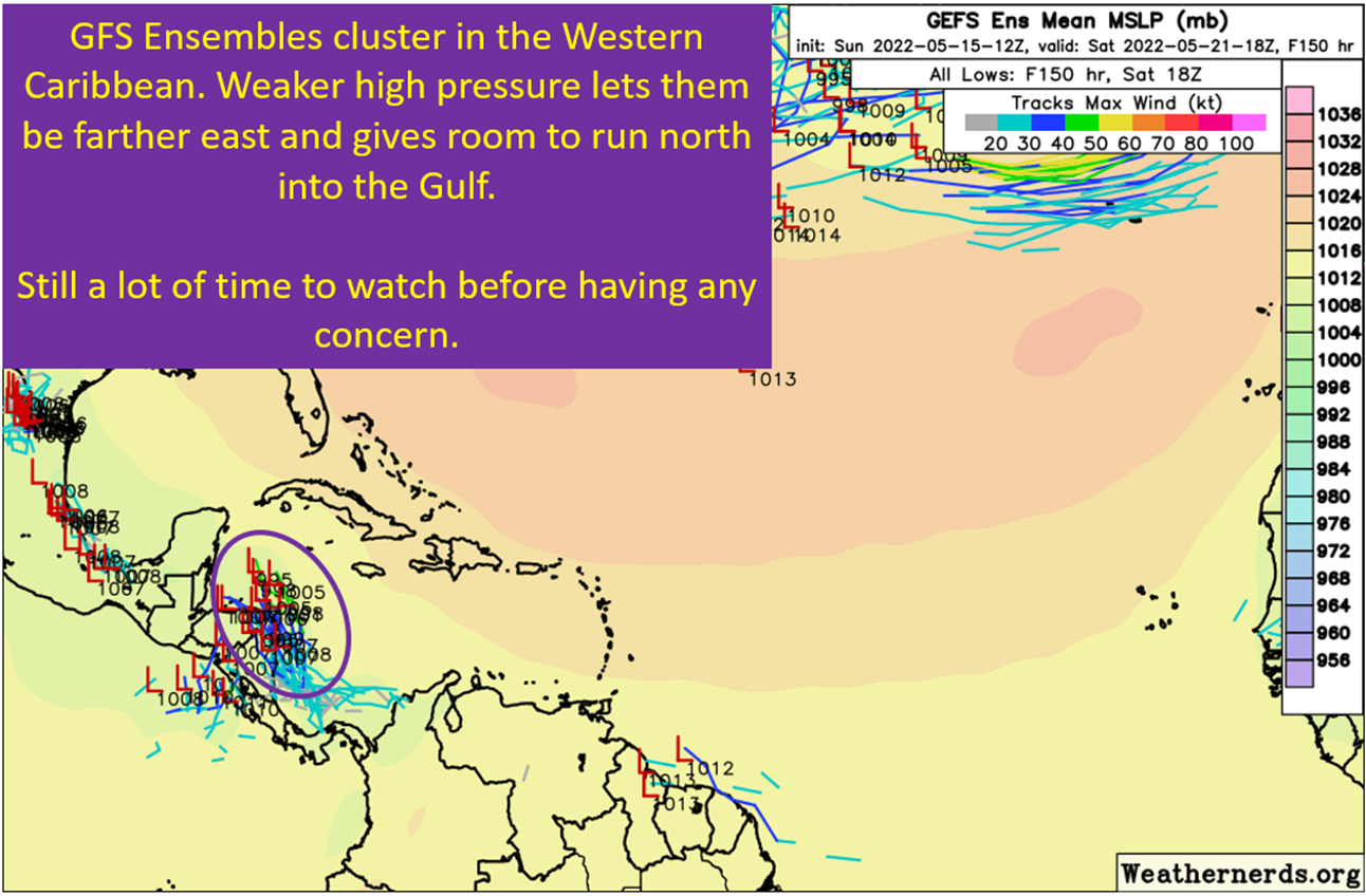
GFS Still Wants Tropical Storm Alex To Happen
The GFS remains consistent on the timing of tropical cyclone formation by next weekend. An early tropical wave comes into the forming Central American Gyre. There’s a CCKW moving across at the same time that also promotes tropical formation. The background state is there for something to form, that isn’t in debate. What is involves placement of the potential tropical system, specifically if it will be Pacific or Caribbean based. Also, it could just get buried over land and nothing form at all.
I’m not going to dwell on the period past the upcoming Saturday, because I suspect the operational GFS solutions will be more realistic by then. To give you an idea of the uncertainty here, I’ve got the European ensembles and the GFS ensembles below. Note the obvious differences.
The main difference is the GFS has a bias to underdo ridges, which means there is a bit of an east bias in this part of the Atlantic basin. The Euro sometimes has the opposite problem of overdoing ridges, which gives it a western bias in this part of the basin.


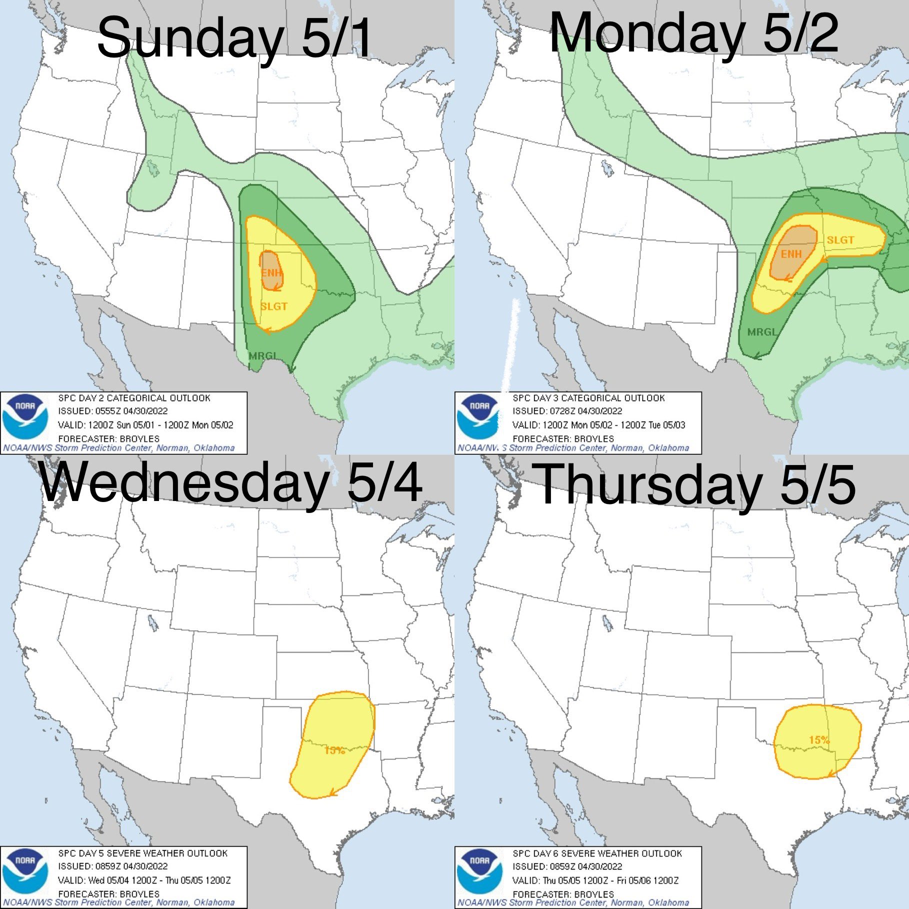
Northeast Severe Monday – Wisconsin/Minnesota Plus Middle Mississippi To Finish Week
This isn’t going to be detailed breakdown, just an overview. On Monday, an unusually potent set up will be in place for the Northeast. It already has an Enhanced on Day 2, which is stout for that region. The SPC Day 2 Outlook describes the set-up:
Thunderstorms will likely be ongoing Monday morning from western PA into WV along the developing cold front, and SBCIN will likely be removed by 15Z due to cool 700 mb temperatures. Storms are expected to become severe between 15-18Z as they develop into south-central NY, central PA, and toward far northern VA. MLCAPE is expected to average 1000-1500 J/kg, with effective deep-layer shear of 40-50 kt. Mixed storm modes may occur, including supercells and QLCS. Damaging wind gusts will be most likely. The tornado threat is expected to increase during the late afternoon as the surface low/trough deepens, low-level lapse rates are maximized, and effective SRH increases to around 200 m2/s2. Cool temperatures aloft and elongated hodographs will also favor sporadic hail in the stronger cells.
SPC Day 2 Outlook on 5/15
Late Week Severe Potential
By Thursday, the severe risk picks up again. Iowa, Wisconsin, Minnesota get in on it on Thursday with the threat shifting southeast by Friday. Again, from the SPC convective outlook:
Global models appear to be in reasonably good agreement through Day 6 across the U.S., moving a mid-level trough out of the Gulf of Alaska and into/across the Pacific Northwest Day 4/Wednesday, and then eastward into the northern Plains Day 5/Thursday, and then the Upper Great Lakes/Upper Midwest and into Ontario Day 6/Friday.
As the upper system advances, a cold front is forecast to emerge from the northern Rockies into/across the northern and eventually the central Plains. Near this front and the evolving surface low, focused ascent across the north-central States/Upper Mississippi Valley region will likely result in afternoon/evening severe storms. Along with potential for large hail and damaging winds, a few tornadoes are also expected, given flow expected to veer favorably through the lower half of the troposphere, while increasing in magnitude with height, suggesting shear favorable for supercells.
Some severe risk may also evolve eastward across the Midwest/Ohio Valley region, as a weak mid-level disturbance moves through westerly flow aloft, near a weak west-to-east baroclinic zone. However, with the north-south positioning of this boundary uncertain, and differing rather substantially in various models, will not highlight this more uncertain risk with a 15% area at this time.
SPC Day 4-8 Outlook on 5/15/22

tl;dr version
Summer is here for the southern half of the country. The humidity will not be that bad, but 90s will be widespread across the Southeast. Over in Texas, some triple digits are likely and will test the grid with some power plants down for maintenance. It isn’t unusual to schedule downtime when it isn’t expected to be that hot, Texas just got unlucky the heat came early.
Down in the tropics, I’m watching for the development of the first system of the season. There are still significant questions to exactly where it forms, but formation wouldn’t be surprising at all. Nothing to get worked up over at this point.
Over the United States, multiple severe rounds are on tap this week. The first is going to be over the Northeast. The later rounds will be for the upper Plains and Midwest. I will post later this week on the details of the Friday severe potential. For now, just be aware it is there.
That’s all for today.
Related Posts
Expecting Danielle By The Weekend. Otherwise, Shear and Dry Air Dominate.
The “Ring of Fire” Continues and Weekly Tropical Update
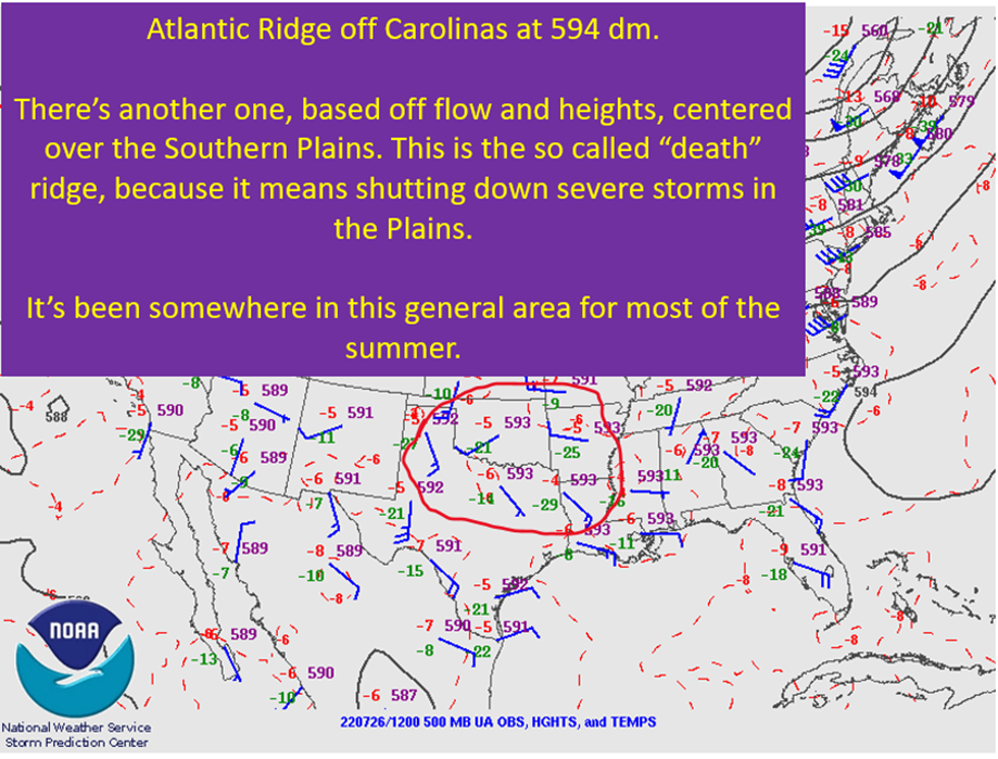
Summer Of The “Death” Ridge: Hot but Helpful In Terms Of Tropics
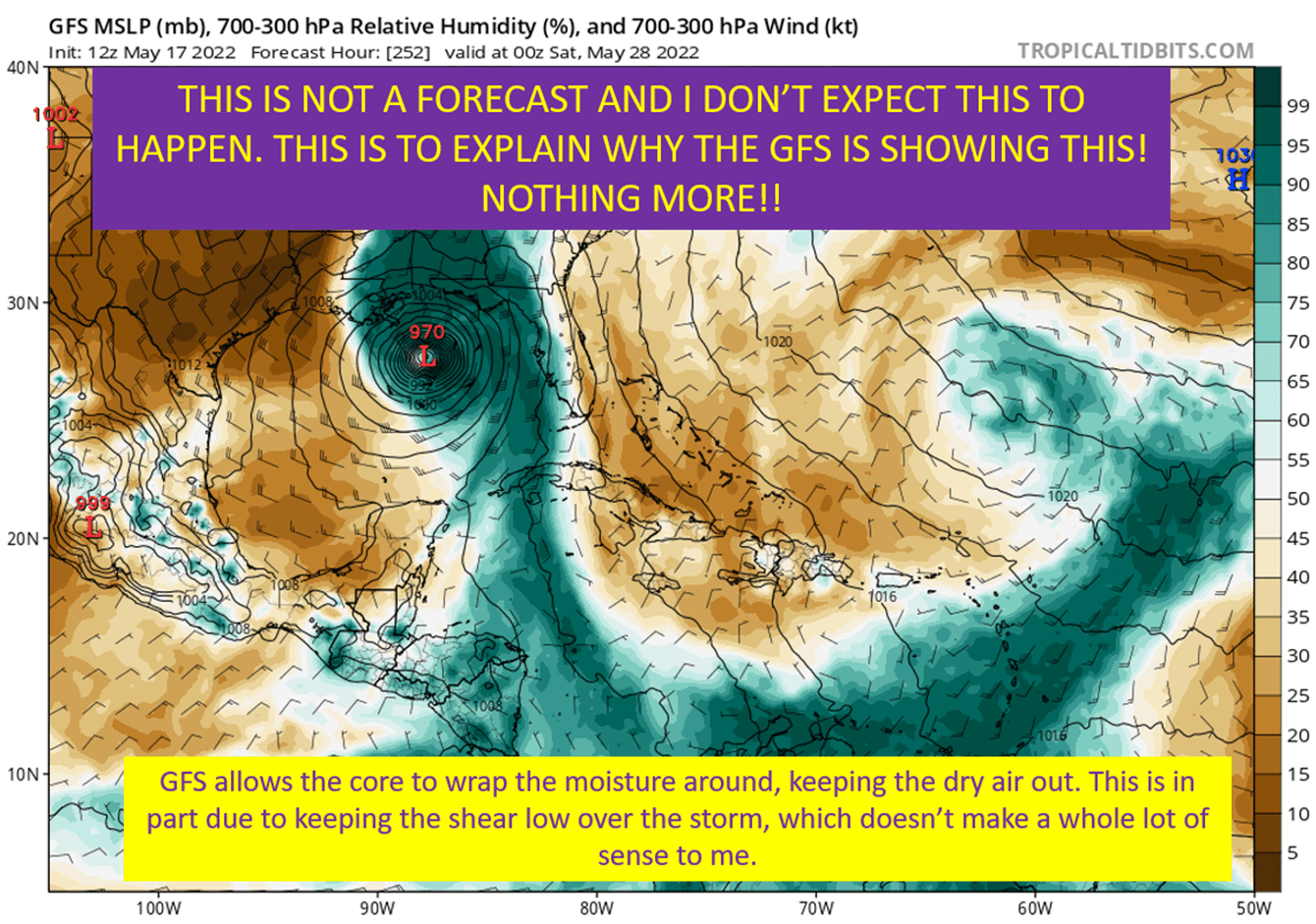
Discussing The Hurricane That Isn’t Happening, Again

The Central American Gyre Is About To Get Going

What the heck is the “cap” anyway?
Weekend Outlook For 5/6 – 5/8
It’s Gonna Be May: Multiple Rounds Of Severe Next Week
Did you miss the 90s? I’ve got good news!