Tropical Storm Ian’s Strengthening Phase Is Starting

What a surprise we got when recon got into the storm tonight. Despite rather shallow though widespread convection all day, recon found the pressure to have dropped significantly to 992 mb. Recon data also showed the storm had aligned vertically, setting the stage for an explosive round of strengthening. Watching the outflow expand to the northeast side on water vapor suggests this phase has started. Looking closer at IR imagery, deep thunderstorms are firing around the center and being rotated around counter-clockwise. That is, you guessed it, another strong indicator Ian is strengthening this evening.
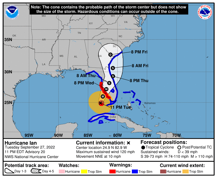
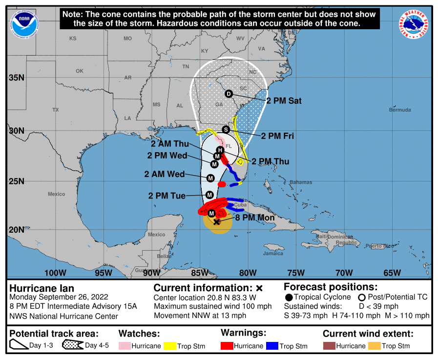
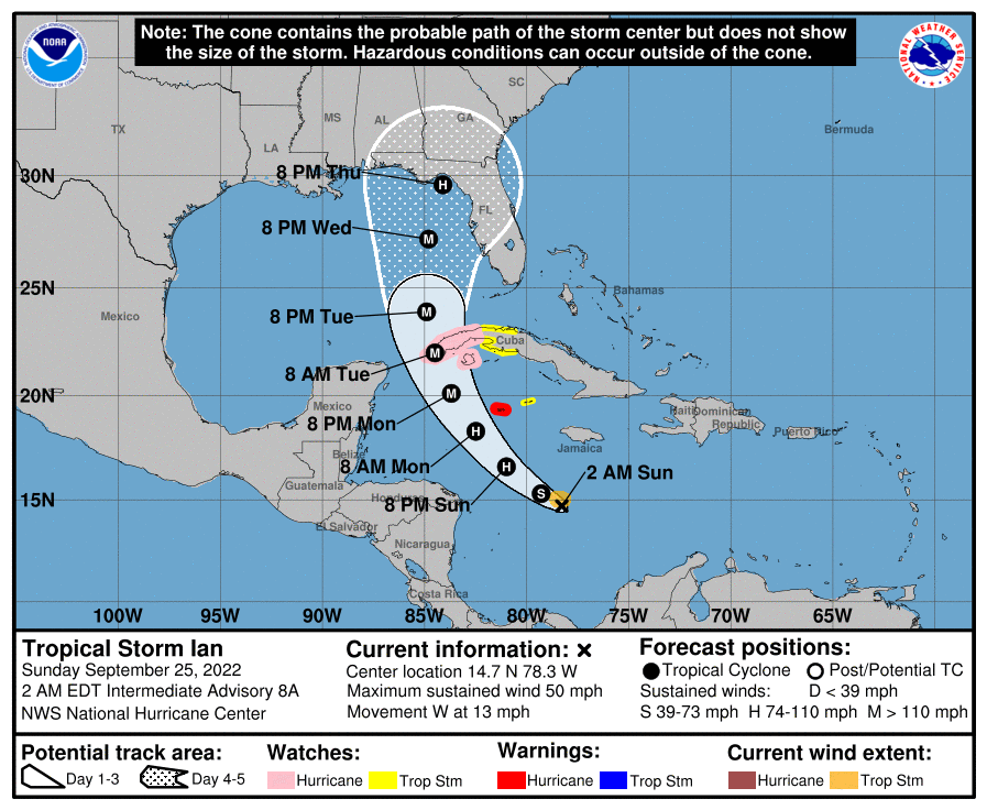
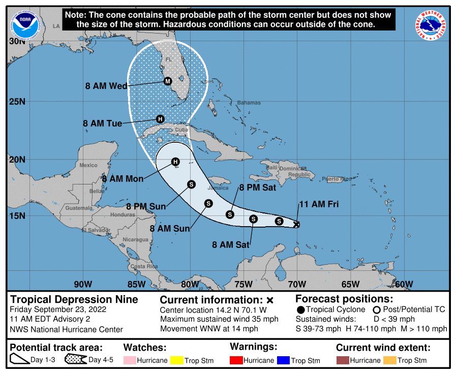
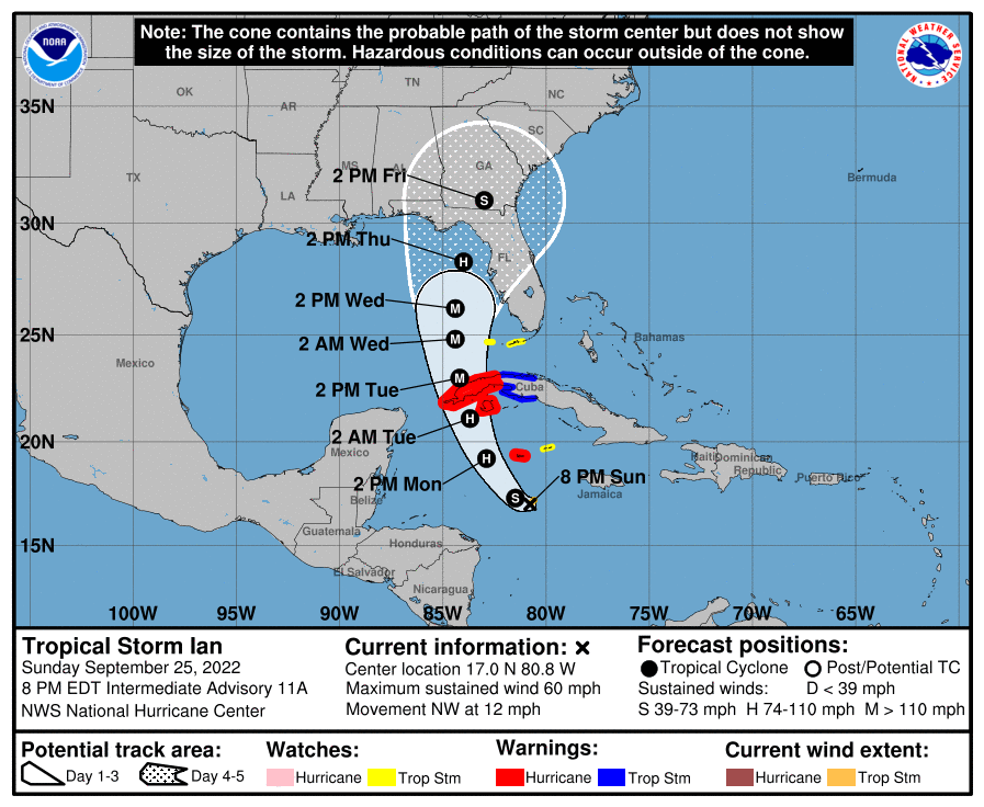
In terms of track, the earlier this gets going, the better. Eastern solutions tend to be weaker for a longer, but present a much more dangerous endgame for the Tampa. Modeling this evening has consolidated along the Big Bend and down through Tampa and to Sarasota, FL.
Tonight, let’s look at why Ian is going to look very different by this time tomorrow.

Deep Hot Water In The NW Caribbean. Low Shear. Enhanced Outflow. All Systems Go!

It’s been well advertised for days, but Ian has everything needed to become a major hurricane if not approach Category 5 status at some point. Deep warm water combined with this nasty upper level setup have been jumping off the screen since this system came on my radar. Remember y’all, it will weaken approaching landfall and it will do so rapidly if the Panhandle is the eventual target. For now though, we’re going to watch one of the most impressive thermodynamic displays in all of nature.
The Process of Building An Inner Core Has Begun

This is how you make a hurricane y’all. Deep thunderstorms are firing near the center and getting rotated around the center as well. This immense release of heat leads to pressure drops, which leads to more water being picked up. Guess what that does? Releases even more heat, dropping the pressure more, and the cycle continues. This will likely be named a hurricane overnight and could easily by a major hurricane by tomorrow afternoon.
Models Converging On Florida

The Tampa scenarios are increasingly of concern this evening, as we are getting to within three days if landfall is to happen there. In addition, a Tampa area landfall would not allow the weakening the models going into the Big Bend or Panhandle would experience. Tampa is very vulnerable to surge, so interests in that area should start their hurricane prep and consider evacuation if you’re in a low lying area.
The scenarios into the Big Bend would be preferable, as the storm would be crashing into a low population area and falling apart at the time. Obviously I’m not wishing this on anyone, but the scenarios showing a Tampa landfall would have a dramatic impact on millions. I’m hoping this avoids Tampa
tl;dr version
Tropical Storm Ian is going to be Hurricane Ian very soon. The advertised period of rapid intensification appears to be on. Increasing outflow and deep convection around the center of the storm all point to strengthening this evening. Since the water is very warm and the upper levels are so supportive, there’s no reason to think this is a headfake. This will be a very different looking storm tomorrow evening.
The modeling has also started to converge on the Big Bend or West Coast of Florida. The scary scenario is one that goes to Tampa as a major hurricane. Those farther north solutions will see a sheared storm rapidly losing strength on approach. That would be the preferable solution, as long as you don’t live in the Big Bend.

